
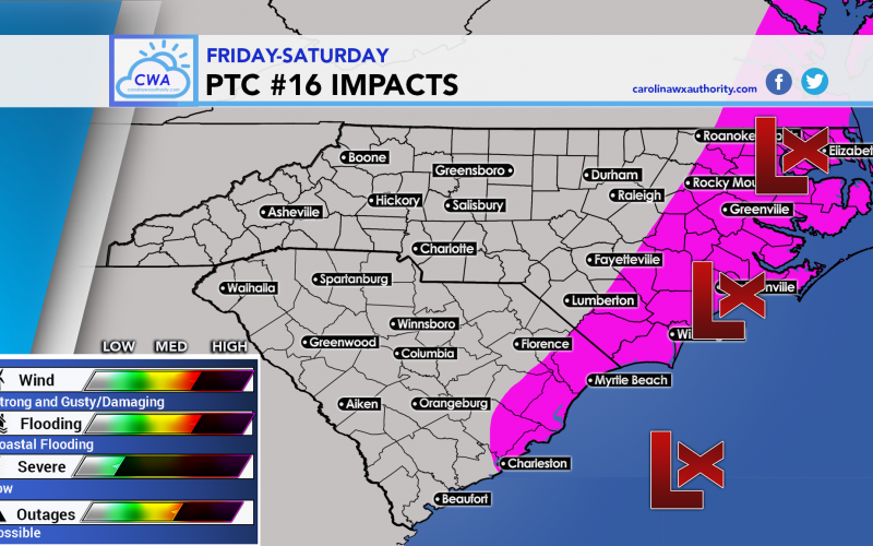
PTC 16 has formed and will continue to strengthen into Friday. This storm system could become a tropical storm, however it will have many extratropical characteristics. This means it will feel more like a nor’easter. The timing is Friday and Saturday from south to north.
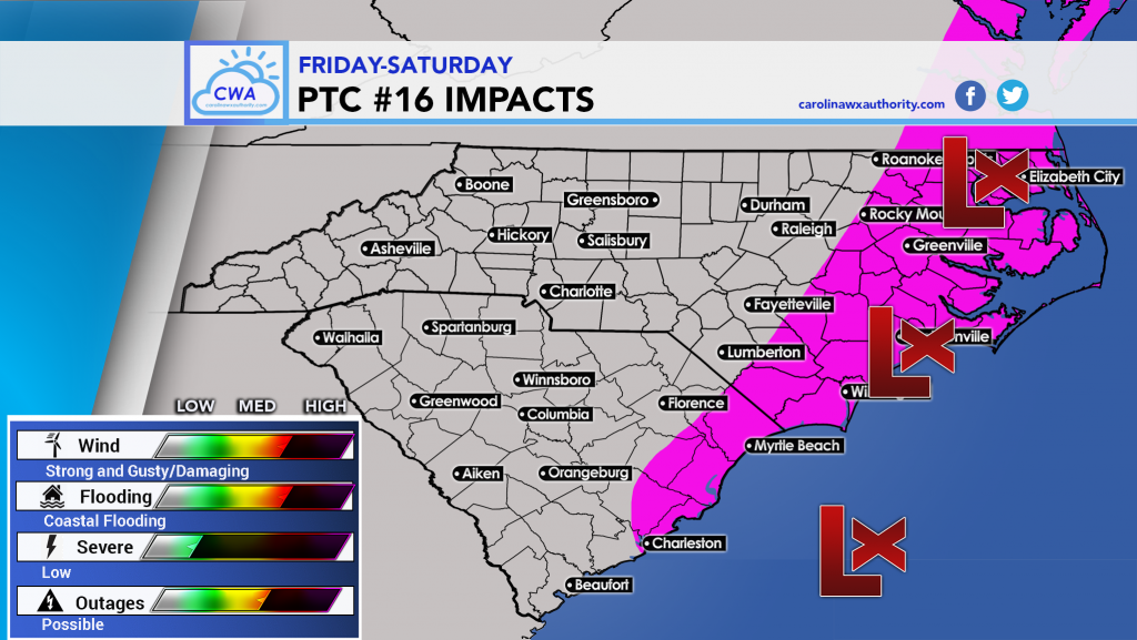
In the pink area, we expect to see winds gust to 45mph but possibly higher along the immediate coast. There will be rough surf and rip currents so going in the water is not recommended. Rain will be heavy but gusty winds could cause local power outages.
Friday and Saturday looks like a wind-swept rain for many including inland, but not too far west in places like Charlotte. Coastal flooding will see a medium-high chance if not high. No tornadoes expected but be aware this can change if the system holds more tropical characteristics.
Overall we think damage will be limited, and it’s more of a crappy day to be outside and on the roads. But the winds could bring down some trees and branches so don’t park directly under a big tree.
All for now!
-CWA
Official link: https://www.nhc.noaa.gov/graphics_at1.shtml?start#contents
You must be logged in to post a comment.