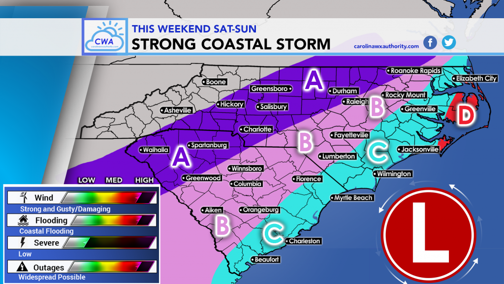
As our coastal storm gets its act together tonight and into early Saturday, winds at the coast will begin to pick up. This is expected to be a decent coastal system, brining heavy rains and high winds to not only the coasts, but also well inland.
Coastal flooding is a concern as are damaging winds. Also, in the pink and blue, and especially red below, power outages will likely be widespread.
Below is our forecast map and the legend below describing what each location should expect.

From StormTrackerSacher:
AREA A: This area will be isolated to scattered showers if anything.
AREA B: This area can expect 0.5-2” of rain and 30 mph + wind gusts.
AREA C: East of I-95 1-4” of rain and 40-50 mph gusts.
AREA D: Outer Banks , Hatteras and coastal NC worst impact with 3-6” of rain and gusts over 50 mph possible.
“As for outages, I’m thinking isolated to scattered between I-85 and I-95 and scattered to numerous East of I-95”
This is what Jesse tells me folks. So, it sounds like we are in for a ride. Pay special attention to the radar tomorrow, and any advisories from your local NWS!
Jesse has mentioned, “If only it were January…”
Stay safe and stay home or somewhere safe Saturday!
-Mike


You must be logged in to post a comment.