
After a very hot September and start to October, many are aware that it’s been very dry. There has been a “flash drought” where a heatwave suddenly has dried up fields, lawns, and forests to the point where things have turned brown.
There will be some decent rains for central/northern SC and southern NC on Sunday into Monday, and then more rounds of rain will move across our forecast region next week.
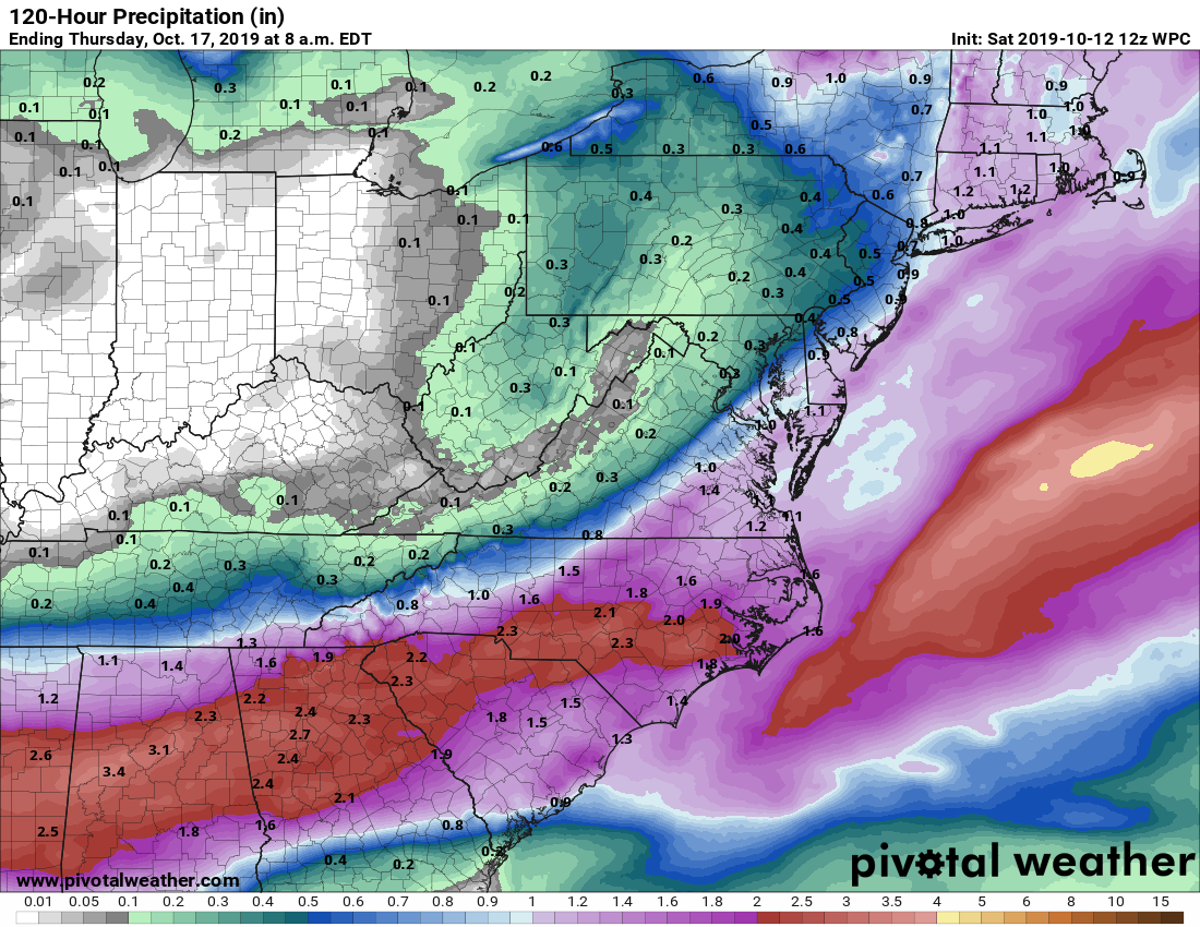
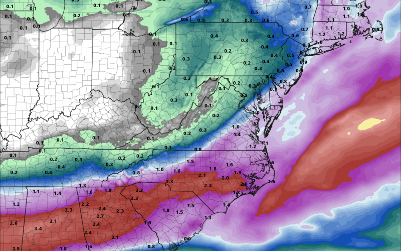
Totals in the image above are cumulative from Sunday to Thursday. This is GREAT news as this rain will be MUCH needed! From Georgia all the way up to Southeast VA will have their drought temporarily quenched.
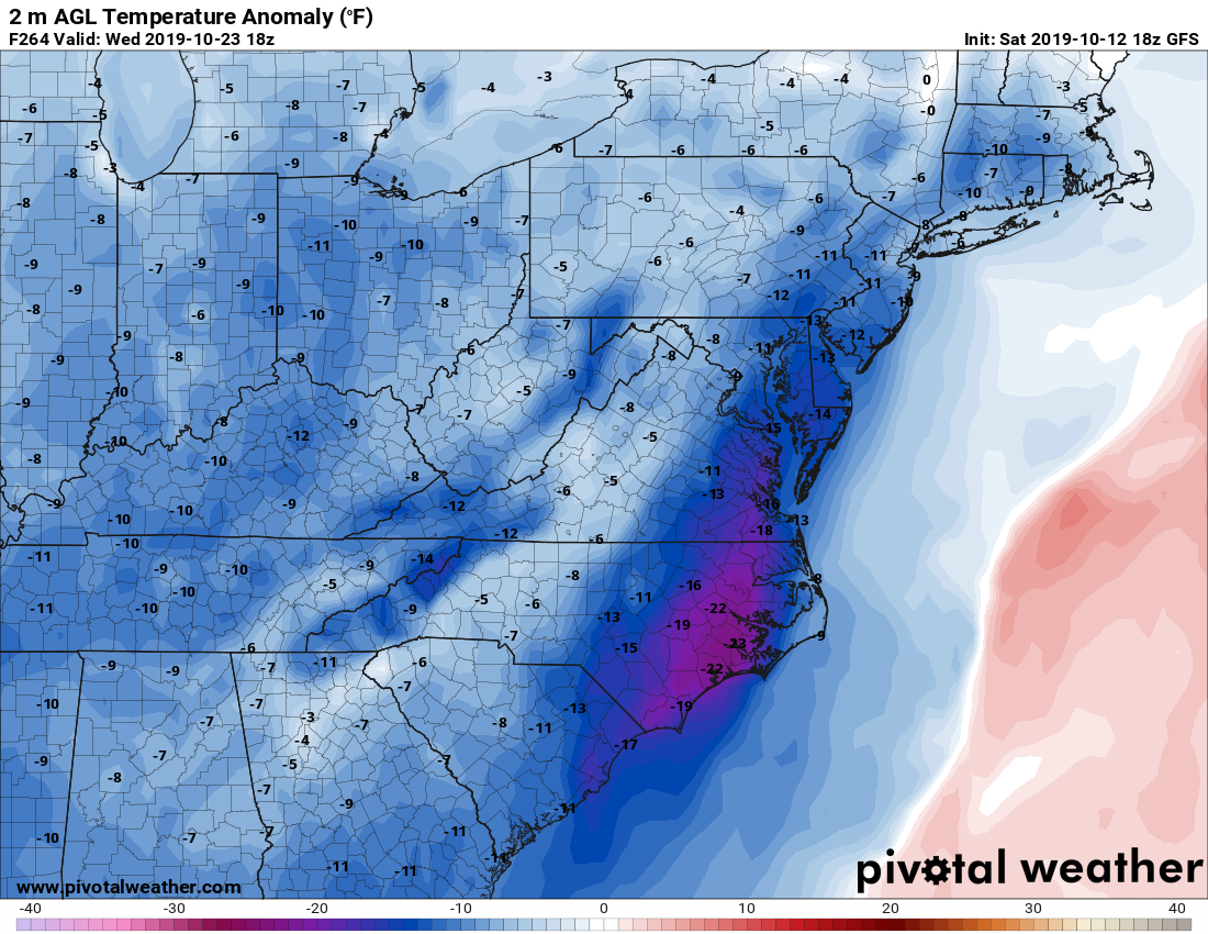
According to our previous long-range article, the rain will be more common as we enter late October into November. Shots of colder air will also start to increase.
We will be overall cooler than average, but it’s unclear whether we will be well-below average or slightly below average through the end of this month.
Be safe and be sure to DRIVE SAFE! Wet leaves and rain are not a good combination and contribute to wrecks. Remember to turn on your headlights if it’s raining, whether it’s daytime or not.
-CWA
You must be logged in to post a comment.