
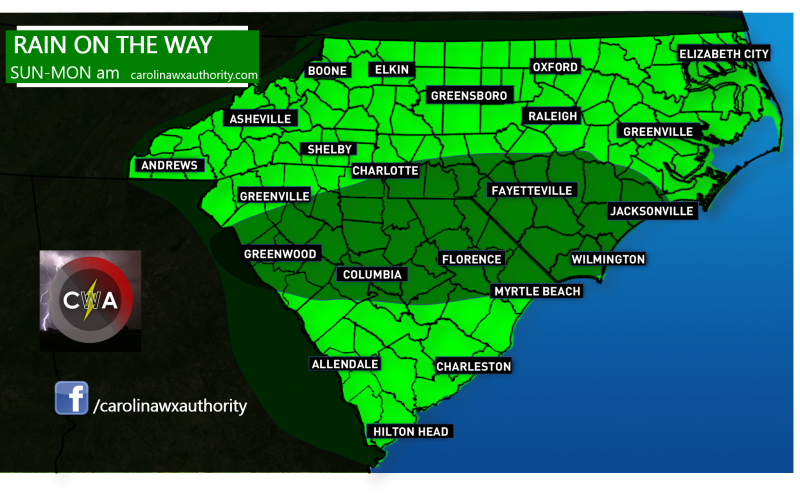
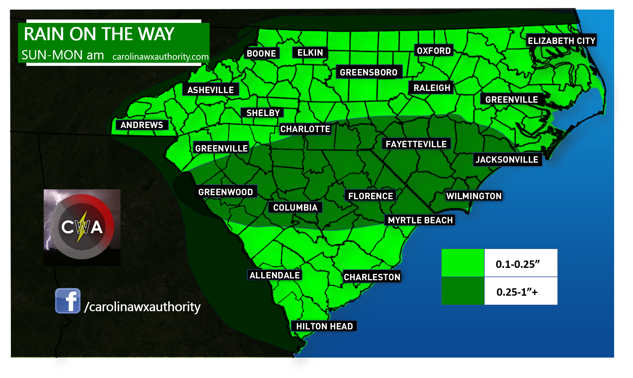
RAIN ON THE WAY
A powerful cold front that has swept across the middle of the country is slowing it’s roll as it heads into our region today, tonight, and tomorrow. This front will eventually stall on top of us. As a result, rain and showers will develop on Sunday and last into Monday for most of NC and SC. This rain is MUCH needed, and we will take ANY amounts we can get at this point. However, this will pose a DANGER on the roads, and driving conditions will be hazardous since it has not rained in a while and the roads will become slick, especially on top of wet leaves. Please keep this in mind if you are driving when it is raining, and use headlights.
The highest rain amounts will be in north central SC and southern NC where amounts could locally exceed 1 inch. Elsewhere across the region, we can expect anywhere between a tenth of an inch to a quarter of an inch.
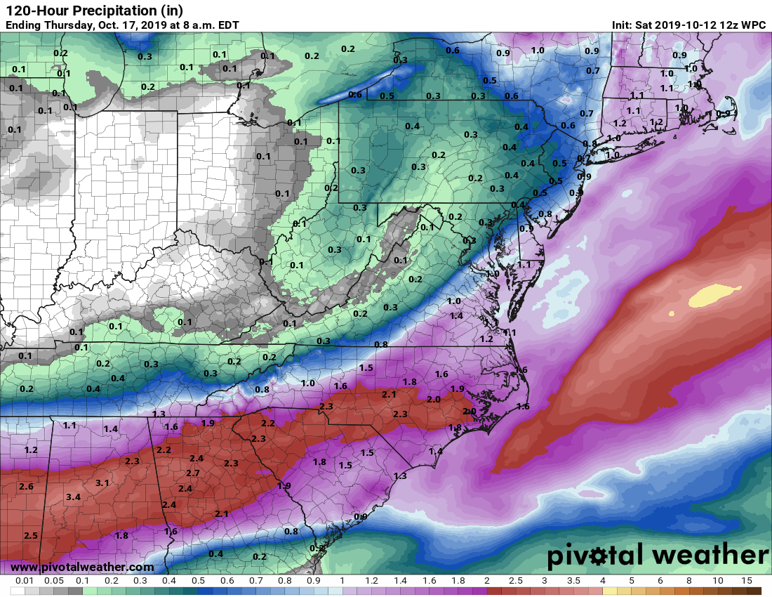
This is GREAT news, however we need much more rain to bust the ongoing drought.
MUCH more rain is expected by Thursday morning, which is more welcome good news! Another inch of rain or so is expected across NC and SC!
If you have work or school on Monday, leave yourselves extra time in the morning due to rainy conditions and heavier than normal traffic. There could be a lot of wrecks so slow down and stay safe. Bring an umbrella tomorrow and Monday!
-CWA
You must be logged in to post a comment.