
MORE RAIN ON THE WAY
Another systems is brewing in the Gulf, and we could be affected here in the Carolinas some way this weekend. The remnants of Nestor moved across our region last weekend, bringing some tornadoes to the Carolina coastal areas. If this disturbance tracks just to our west in the mountains, we could see some severe weather here in the western Carolinas including spin-ups. However, the big story will once again be the rains, as most of us still need it due to an ongoing drought.
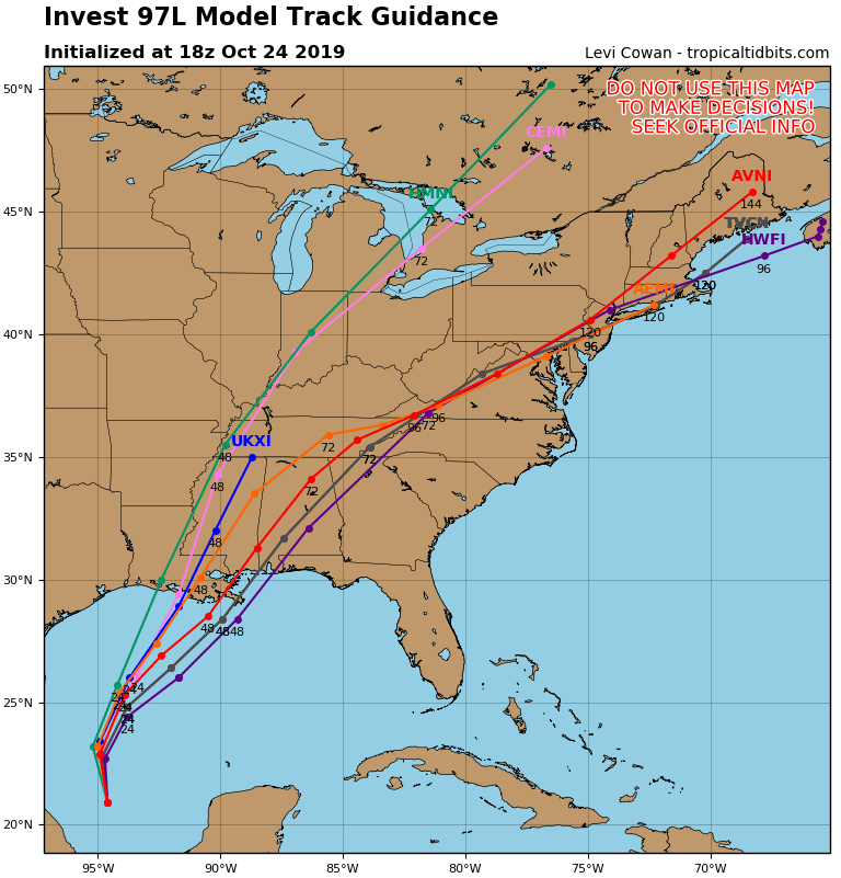
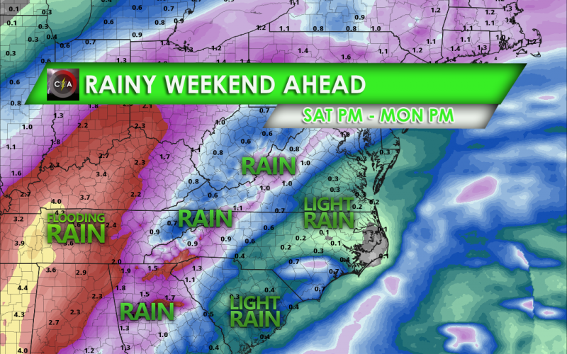
Late Saturday afternoon or Saturday night the rain is expected to overspread our region from the south. The current thinking is that the heaviest rains will be to our west in Tennessee and Mississippi, where they could see flooding downpours. The mountains are expected to receive heavier rains than the Piedmont. Coastal regions will see the lightest rain amounts. Again, the Piedmont could see severe storms including tornadoes depending on the track of this disturbance.
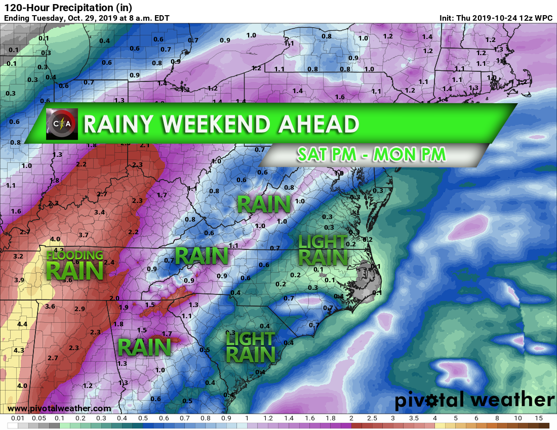
For the Piedmont, it will not rain the whole time and may either start later or sooner than expected. The takeaway is don’t expect to be completely dry. The farther west you go, the more likely you will see substantial beneficial rains. The timing and impacts of heavy rain will depend on the exact track of the tropical system working its way up from the Gulf.
Stay tuned for more!
-CWA
You must be logged in to post a comment.