
All eyes to the skies on Monday as a powerful cold front sweeps in from the west, and could touch off some thunderstorms with damaging winds, and even a few tornadoes. This will be the beginning of a moderate pattern change.
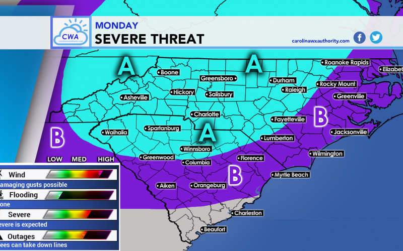
Below is the graphic for the severe risk for Monday, and is using the SPC as guidance.
AREA A: This area has the highest risk for damaging winds and tornadoes. Winds could gust in excess of 58 mph, causing trees to come down and power outages. This area is outlined as a Slight Risk by the SPC.
AREA B: This area could still see severe storms and tornadoes, but not quite as likely. This area is under a Marginal Risk by the SPC.
Folks should keep alert to the sky tomorrow for anytime of day and should consult the NWS for watches and warnings. The timing looks like it will be near sunset or even just after dark for Charlotte, potentially around 8pm. The line of storms will move east later tomorrow night after dark.
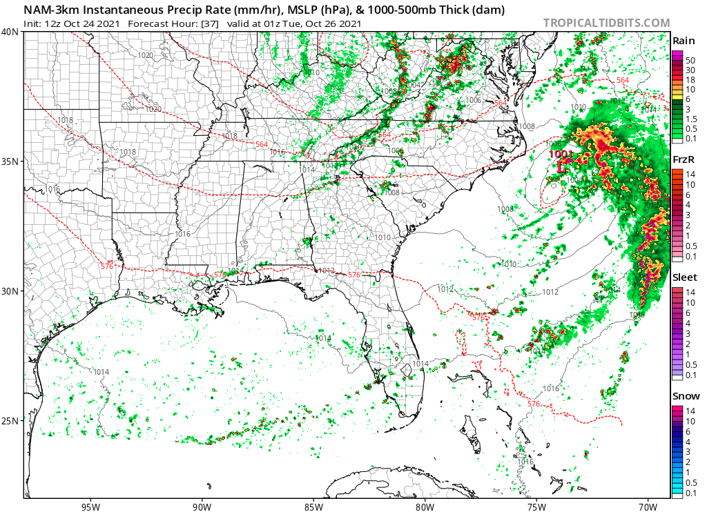
Below is the estimated radar for 9pm Monday:
If you live in either shaded area, especially Area A, have a way to receive warnings and take action if necessary. Again, timing should be late tomorrow into tomorrow night, but stay alert in case any storms arrive earlier than expected.
Stay safe, and please share this article warn friends and family!
You must be logged in to post a comment.