
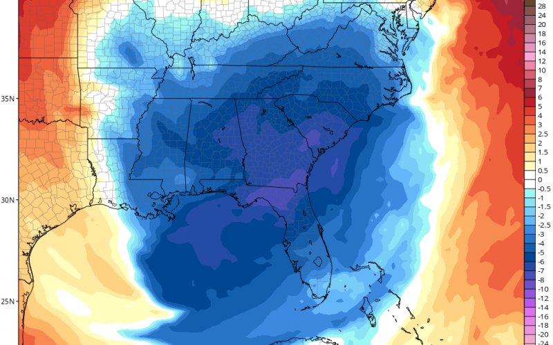
Our major pattern changes is still on target for the end of the month. A powerful cold front will usher in some of the coldest temperatures of the season around the 30th. Below is the GFS showing our shot of cold that is still on schedule:
What the model could be signaling is some kind of East Coast storm, that could end up bringing some flaks to the higher elevations. We are not expecting anything for most of NC or SC in the form of frozen precipitation. But this is the kind of pattern you want to see if you want snow.
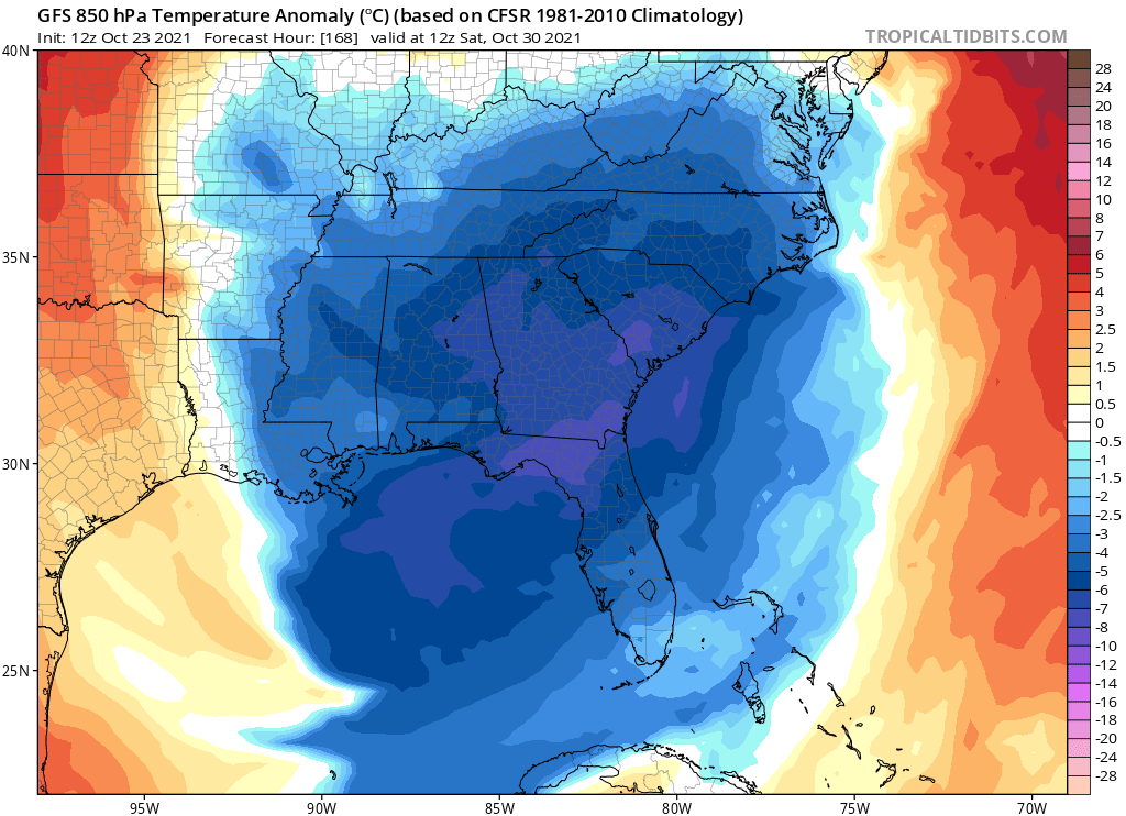
It also still looks chilly on Haloween.
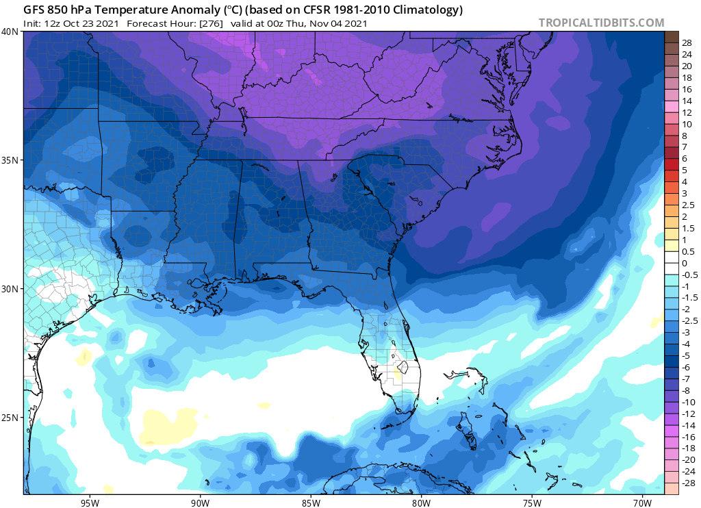
After the 1st, reinforcing cold shots look probable. These cold shots may be colder than what we experience on the 30th or the 31st!
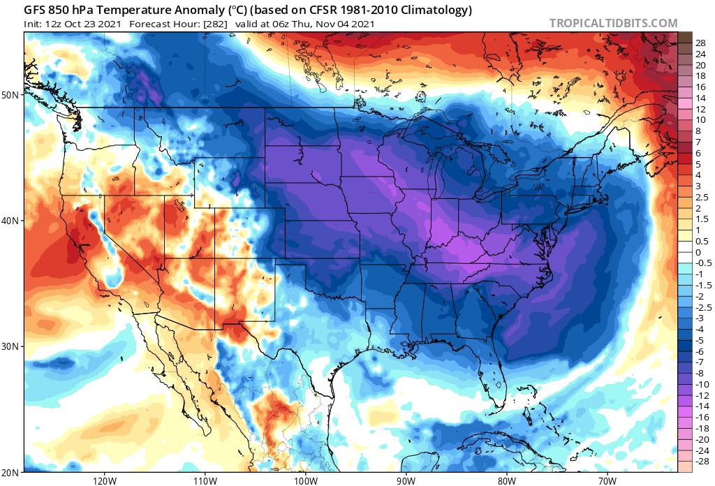
In fact, take a look at much of the country below, as there could be a cold wave that engulfs many.
So it looks like the pattern change will be felt starting on or around the 30th. And then there could be repeated cold shots into the first week of November.
Comment on our FB post if you like early season cold or not!
You must be logged in to post a comment.