
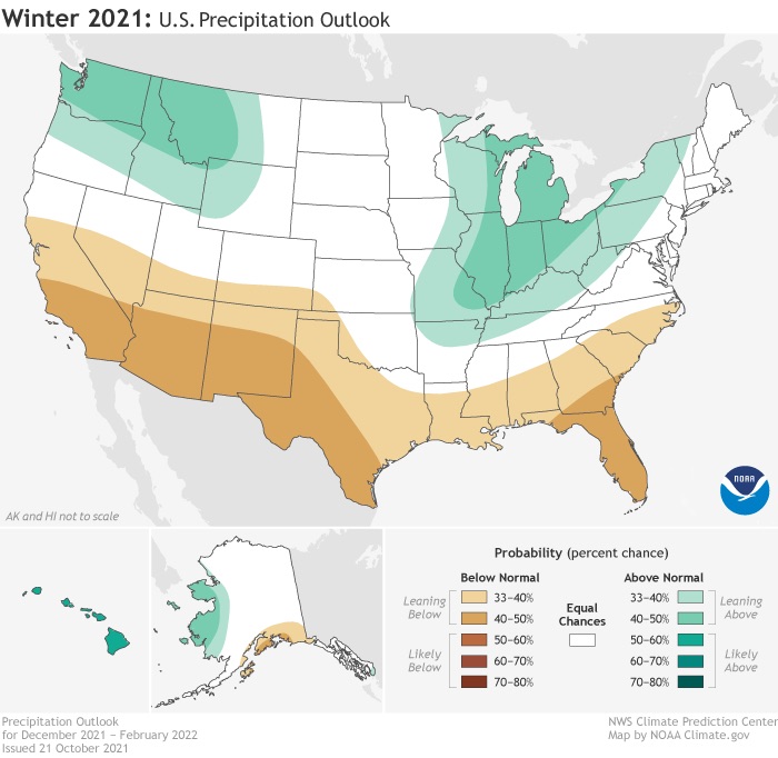
Much to cold and snow lovers discontent, NOAA has released their Winter Outlook for 2021-2022. It is not what you want to see if you were expecting an epic winter in the Southeast.
We are heading into a La Nina, which means cooler than usual waters along the Equatorial Pacific. This has impacts on our jet streams and overall climate here in the CONUS. For these types of winters, warmer and drier conditions overall are expected. However, this is not our forecast, and there are other factors at play rather than just an El Nino or La Nina.
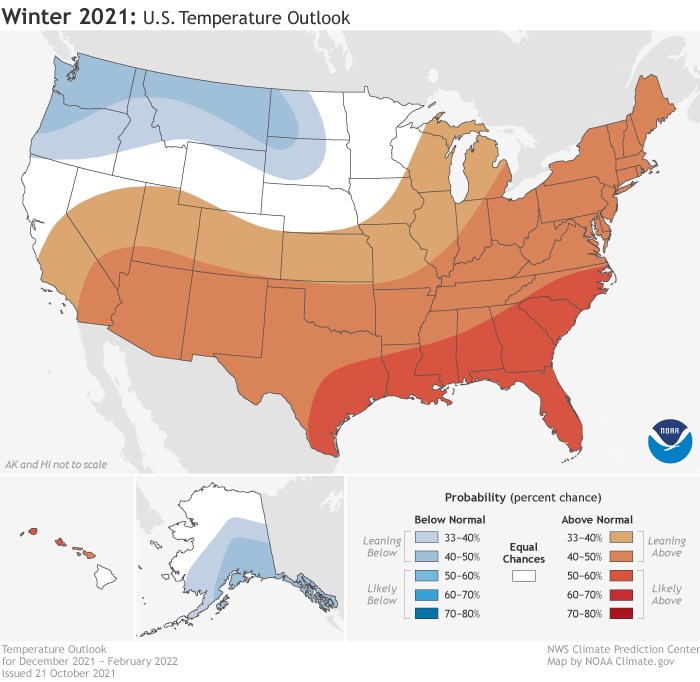
Does this mean the ENTIRE winter will be warm and dry? We don’t think so, as there is the possibility of early cold outbreaks, and even early winter storms across the Southeast this year.
We have not released our winter outlook, and may or may not release one this year, due to the high overall uncertainty with the skill of long-range winter forecasts. We may, however, issue some outlooks in the coming weeks.
Stay tuned!
You must be logged in to post a comment.