
The Euro ensembles have been indicating a below normal temperature regime for the end of this month. The GFS has also caught on, but not so much the GEFS ensembles. They may catch on after a few more days.
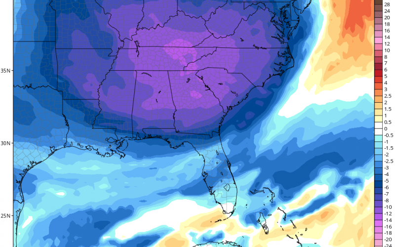
Regardless, we are either looking at cold or some kind of storm on the 30th. Below is the GFS operational, and shows the departure from normal at 5,000 feet above the surface.
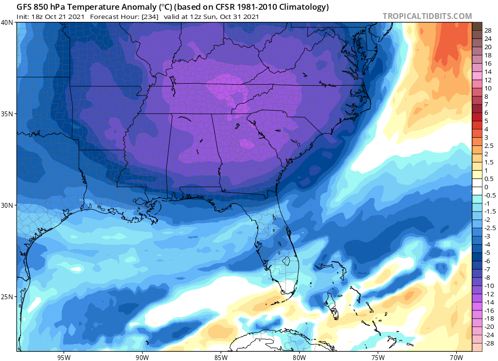
This is indicative of a somewhat decent cold outbreak, however East Coast storms are not uncommon around Halloween. It is also not uncommon for the NC and TN mountains so see some flakes.
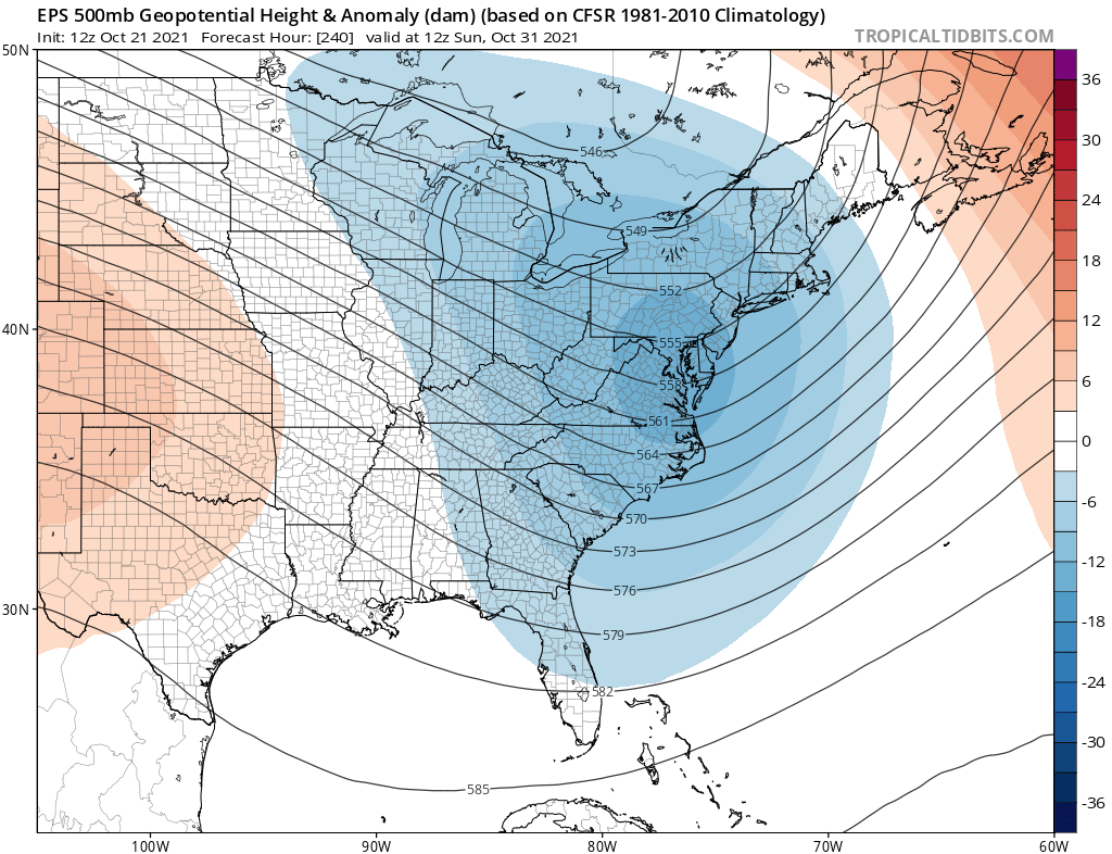
The Euro ensemble below is indicating a trough for the East Coast for Halloween morning:
Climatologically speaking, a powerful cold front usually moves through on or near Halloween which could touch off some severe storms, especially in Dixie Alley. We will have to monitor the severe situation as we get closer to the end of the month.
For whatever reason, if the models are overdoing this cold shot, then a bust scenario would be near average temperatures.
For now, enjoy seasonal October temperatures, until the change comes later this month and as we head into November.
You must be logged in to post a comment.