
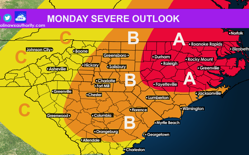
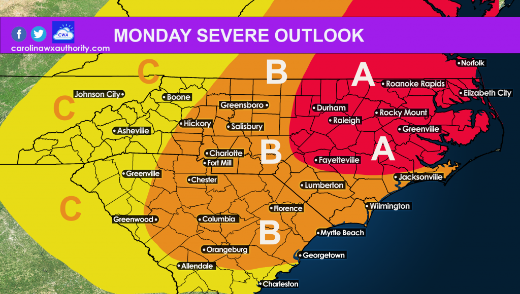
As an upper-level disturbance aloft swings down from the north, severe storms usually result this time of year. Therefore, an enhanced risk has been issued for much of the Mid-Atlantic. See the map below for a breakdown of what conditions are expected for your area.
Disclaimer: Always consult the NWS for your safety and property.
AREA A – Enhanced Risk outlook….Severe storms are most likely in this area, as energy pushes east on Monday. Damaging winds are the main threat, but a few tornadoes are not out of the question.
AREA B – Slight Risk Outlook…Storms will likely form in this area with numerous severe. Damaging winds are at an elevated threat level for Monday.
AREA C – Marginal Risk outlook…Storms in this yellow area will be marginally severe, but any storm that does form has the capability of being severe and damaging.
Monday will be a day to check radar and weather reports, especially if you are outside and/or have travel plans. Once the storms get going, we will have a better idea of where the activity will be.
Area A has the potential to see the brunt of the action. Stay safe!
You must be logged in to post a comment.