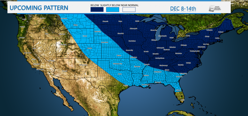
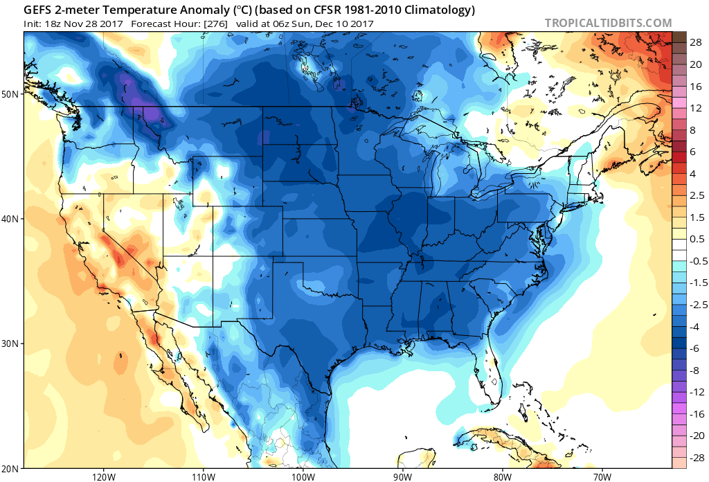
We are looking at an Arctic intrusion that is on track to grip the eastern half of the country. If you like the cold, then all you will have to do is not wait too long. Because it is coming. Now, some of you may ask, is this normal for this time of year? And the answer is yes. However, if this is an EXTREMELY cold air mass, then it is not normal for this time of year, and actually below average. We will be seeing a much below normal temperature trend starting around the 8th. This trend will likely last into the 14th or so, maybe even beyond, but that is not certain yet.
It might get cold enough for as far south as Orlando to feel the chill. Some of the orange groves may need to be protected from a freeze in the Panhandle. Otherwise most of the coldest air stays in the Carolinas, Georgia, and northward. It is interesting to note, that the coldest air will likely be over Europe. The Polar Vortex will break off some pieces, and one very strong piece is forecast to park itself over Europe.
The GEFS ensembles show quite a cold airmass entrenced over the U.S. This could favor the possibility for some kind of major storm system that will bring snow. However who gets what, and anything at all is even more uncertain than the lingering cold.
We will be warming up and then some back door cold fronts will cool down mainly the Northeast, and it will be tranquil for the time being. Just keep in mind of the major flip coming after the 8th.
-Mike G.
If you liked reading this, please share with your friends using the buttons below!


You must be logged in to post a comment.