
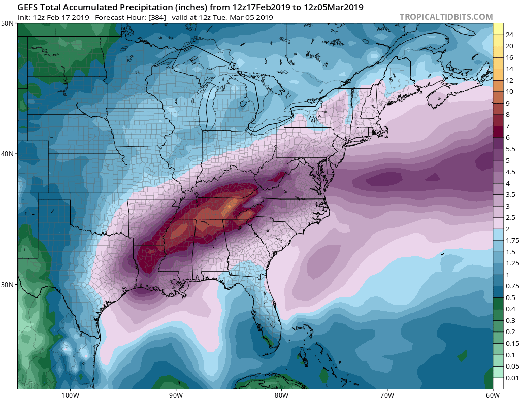
As the pattern gets underway for rain in the Southeast, residents should prepare for flooding as grounds are already saturated from previous rains dating all the way back to last May. It will not rain every day, or all the time, as the below graphic represents total impacts from now until March 5th. Landslides, river and creek flooding, and water rescues are all likely over the next 2 weeks. The trend will begin mid to later this week and will continue through next weekend.
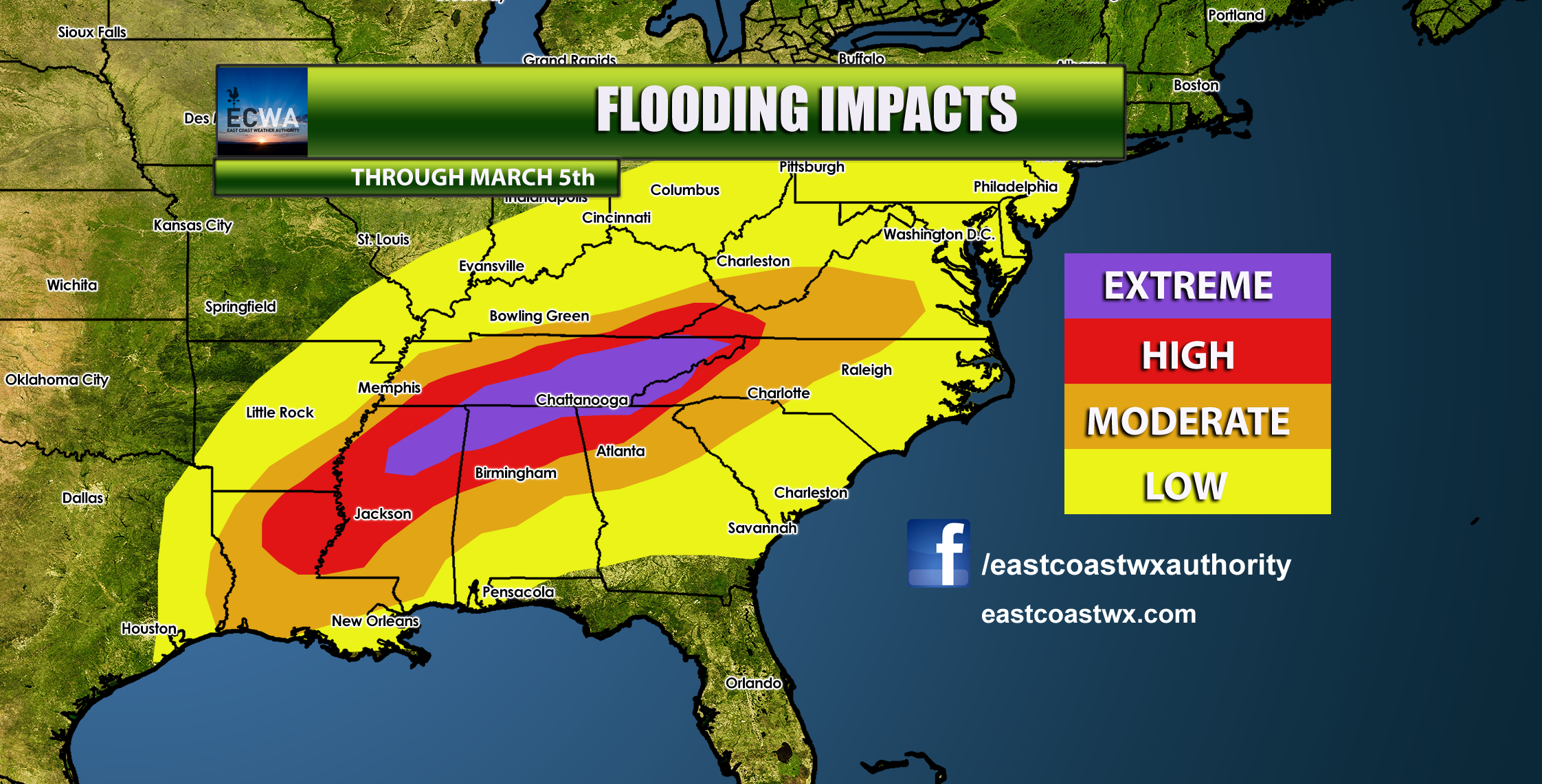
The heaviest rains will fall in and just to the west of the mountains. Eastern TN, southwest NC, north GA, and northern AL and MS will experience the most rain and thus highest impacts. Do not drive into floodwaters, as the water may be deeper than you think!
Please share this article with anyone who you know that lives in these areas!
-ECWA
You must be logged in to post a comment.