
It would be a snow lover’s dream in the South to have another winter storm in two month’s time. There is uncertainty however. We do know the southern branch of the jet stream will remain active. However, enough cold air has to be in place ACROSS the SOUTH in order for it to snow. Otherwise it will be mainly rain events (and we do not need more rain, or any moisture for that matter).
Since the southern jet will remain active, the energy sources for storms will be there. Now the question is, will there be enough cold air in place EACH time a disturbance comes down the tracks? We are not sure, but would venture to guess to say, yes anything is possible. EACH TIME an upper-level disturbance arrives in the jet stream, cold air is NOT guaranteed. So many of these storms could interchange between rain and snow, or more rain than snow, or even more snow than rain events. The exact details are still up for grabs.

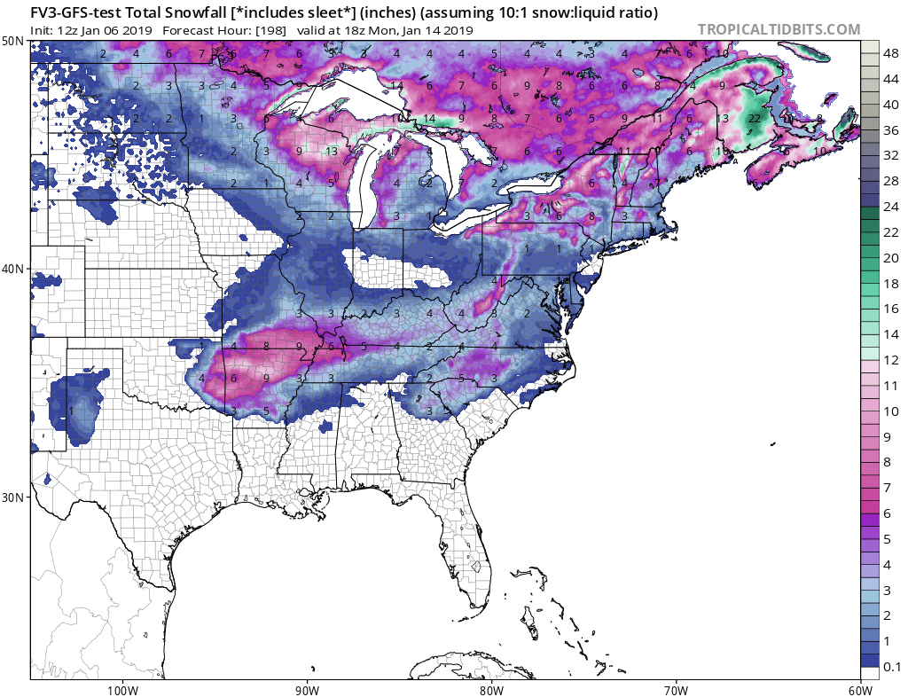
What is the new and improved FV3-GFS seeing? An accumulation of a wintry mix of some sort across the Southeast, including Atlanta and Charlotte.
Don’t forget to also check out or models/live data page before you go! https://carolinawxauthority.com/models
Thanks for stopping by and check our Facebook page often!
-ECWA
You must be logged in to post a comment.