
Good news for snow and cold lovers, there appears to be more to had after January 1st. In fact, it will be mild up until then, but then the pattern changes after and we run into what could be an active Southern storm track. At first, snow comes to mind, however this is not certain yet. This could be rain for the Carolinas and perhaps snow for the mountains. Or, this could be similar to our last event where western and northern NC win out. Details are still too far away to be determined, but what we do see is a buckle in the jet stream off the West Coast. This results in split flow, which means a disturbance can move across the southern US. If it comes close to phasing with a disturbance from the northern segment of the jet stream, then there will be cold air as a source for snow. Again, who gets what or how much is unknown.
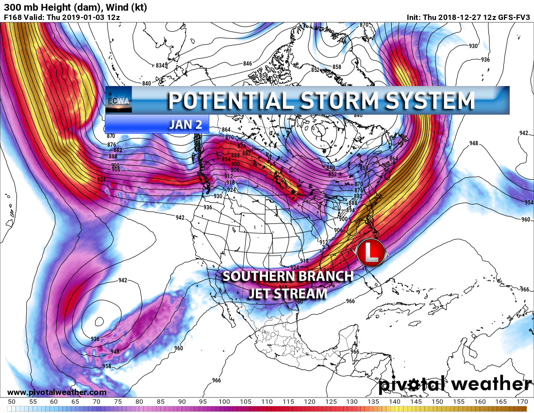
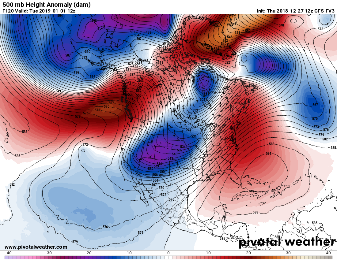
There will be an upper ridge over Greenland at 500mb, which signifies blocking. Notice the shortwave in the western US, how it “swings” downward. This could be our weather maker on the 2nd or 3rd. Cold air would be available from the Hudson Bay and south.
All we can say is that there is an event possible. Some kind of major East Coast storm, either rain or snow, or both depending on location.
Stay tuned! Please share this article if you enjoyed it!
-ECWA
You must be logged in to post a comment.