
The super wet weather pattern we’ve been in for the past two weeks is finally breaking, and much cooler, drier air is pushing southward for a very comfortable, cool end to the month of May and beginning of June.
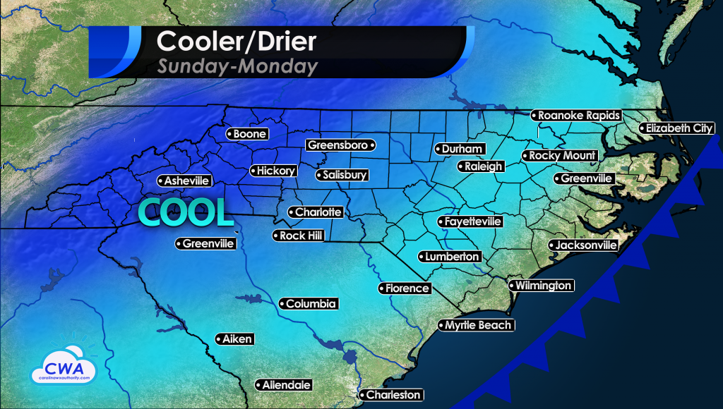
A strong cold front will move through overnight, and Sunday will be a gem, with temperatures in the 70s to low 80s, and much drier air pushing into the region. This will help dry out many waterlogged yards. Monday looks very nice with a cool morning, then a mild afternoon. But this time, the cool spell will only last a couple days, and much hotter air will quickly surge east into our region starting Wednesday.
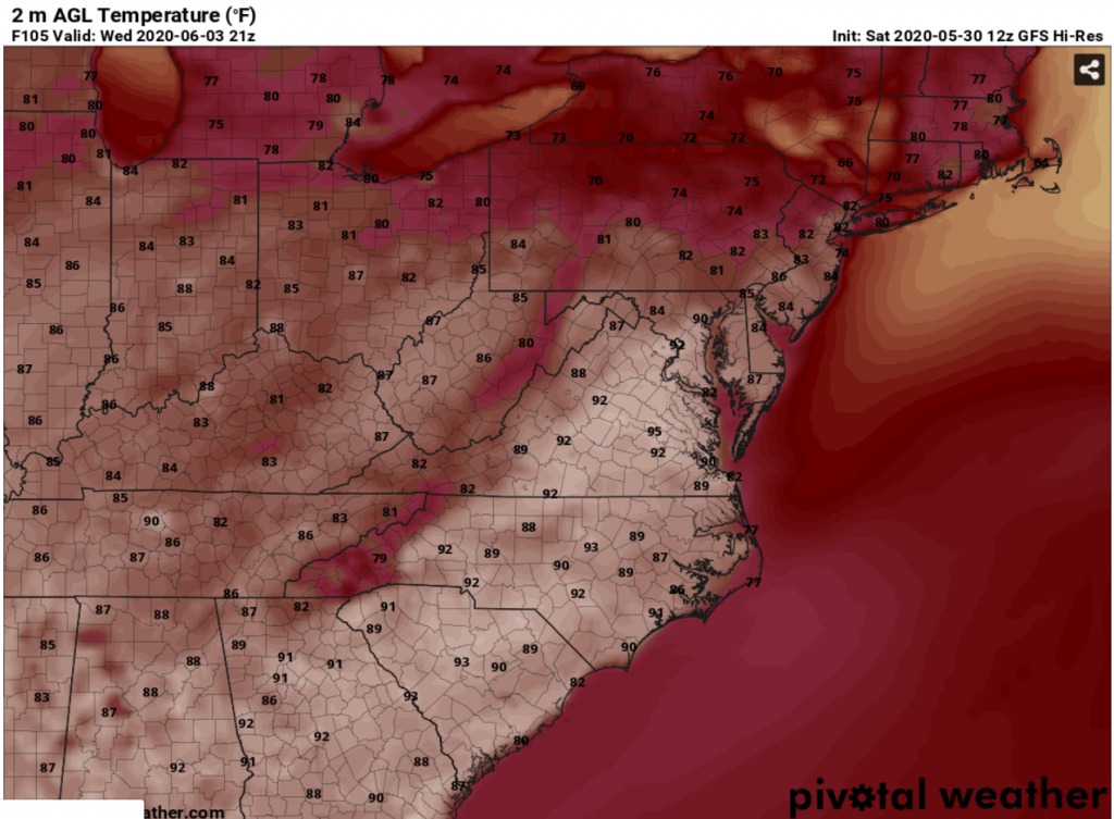
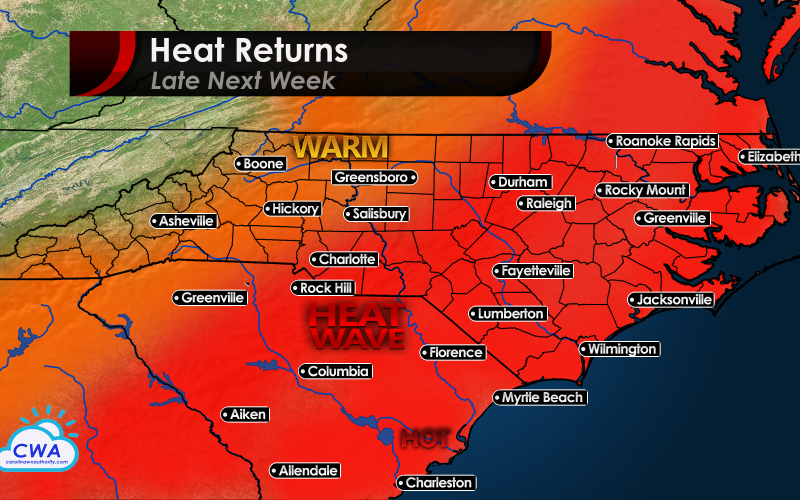
Temperatures running well below average on Monday will surge to above average temperatures on Wednesday, as high pressure builds east from the Plains. This will lead to the hottest temperatures of the season, as the switch gets flicked from 5-10 degrees below average to 5-10 degrees above in just a matter of 2 days.
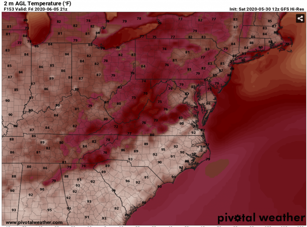
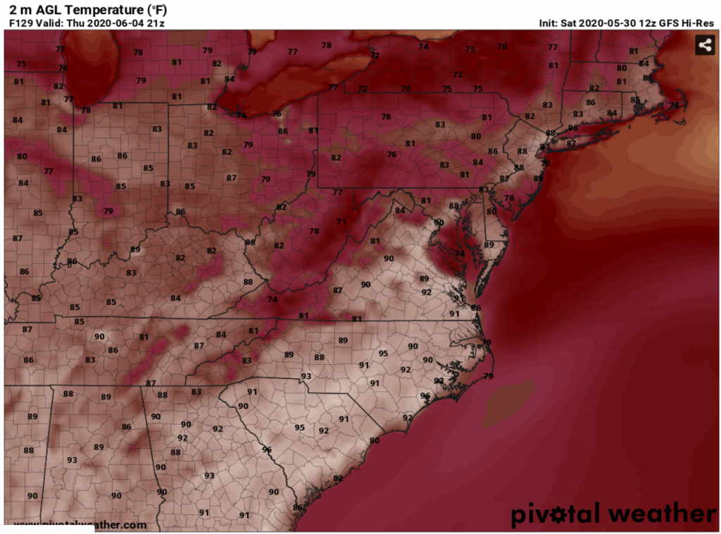
Humidity levels will climb with this mini heat wave as well, leading to an increased demand for air conditioning, as Thursday, June 4th appears to be our hottest day so far this summer. Some locations in the middle of North Carolina and South Carolina could top out at 96-97 degrees. It won’t be as intense as last summer’s early heat wave that saw some triple digit temperatures on Memorial Day weekend, but it will no doubt be a big change from the cooler than average weather we had during most of April and May.
A cold front will push south into the area later Thursday or early Friday and could trigger a few stronger thunderstorms, but overall the week will be drier than average, and ending up hotter than average. Some slight cooling is possible for Friday in northern parts of the Carolinas, depending on where clouds and any precipitation set up. But the overall trend is going to be a warm June, with above average temperatures on the whole for the first time since late March/early April.
The tropics should not be an issue next week, but we are going to be watching the southern Gulf of Mexico and northwestern Caribbean for our next potential system(s). Subscribers will be getting a newsletter early next week with our official summer outlook and tropical outlook, with details on which areas are likely to have tropical trouble, and how the Carolinas could again be impacted this summer and fall.
You must be logged in to post a comment.