
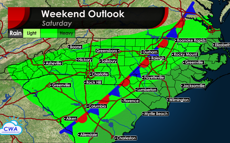
What can we expect for the final weekend of May 2020? Well, more of the same of what we have been having lately, more rain, and thunderstorms. Some storms could continue to trend to the severe side, however we are not expecting anything widespread for Saturday.
Rain will be heaviest east of a stalled out stationary front across the Carolinas. Anywhere from I-95 to the coast is where the heaviest rains will likely fall.
The western Carolinas could see pop-up showers and storms, especially in the afternoon and evening hours. However, rain chances decrease from west to east Saturday night as a nicer day is in store for Sunday.
Sunday will be a much drier day and will cool off as the day goes on. It will likely be the best day this weekend. Sunday night temperatures will continue to tumble, and we will be looking at a very gorgeous day Monday with low humidity and sunshine, but of course, it will be time to return to work.
The plus side is the more rain we get now the less likely there will be a drought later this summer and fall. We will monitor for any flooding threats.
But for now, enjoy as Sunday things will be turning much nicer and cooler later in the day as predicted.
Have a great weekend!
-CWA
You must be logged in to post a comment.