
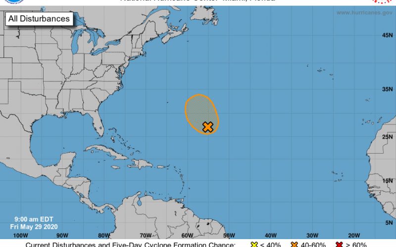
No Atlantic hurricane season has ever had more than 2 named storms before the official June 1st start. There’s a chance we’ll have our third this weekend. The National Hurricane Center has issued a special tropical outlook today that indicates low pressure is forming over the Central Atlantic and has a 50 percent chance for tropical (or in this case, subtropical) development this weekend.
Unlike Arthur and Bertha, this system is not going to be a threat to any land as it tracks northwest and stays well east of Bermuda, eventually turning north and dissipating early next week. No big deal, right? Well it could be a big deal if the National Hurricane Center sees enough of a circulation and high enough satellite estimated wind that they upgrade it to a depression and then a storm.
The next name on the list is Cristobal. It’s not a slam dunk this will happen since a plane won’t get flown into it, satellite estimates are just estimates, and upgrading a circulation to a depression or storm is a consensus decision and needs to be agreed upon by scientists who may have varying understandings of what is going on. Plus the window for development is small as wind shear and cooler waters await by the end of the weekend.
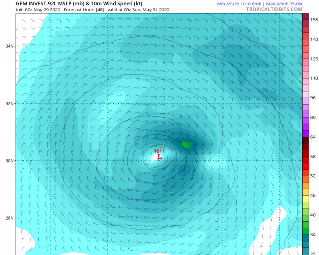
But we at CWA think a record could be broken this weekend as a subtropical depression or storm is certainly on the table. Water temperatures aren’t that warm and the core of the circulation isn’t fully tropical, but models like the Canadian show some deepening of pressure, and Saturday night or early Sunday morning, the potential for 35 knot winds, which would officially tip the scale to minimal tropical storm wind.
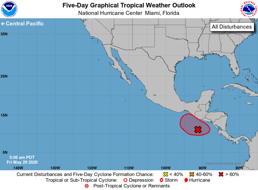
If this system doesn’t get a name, there’s another one to watch in the Eastern Pacific which will cross over Central America and could develop in 5-8 days. A lot will depend on what sort of interaction it will have with land. It’s possible it gets names Amanda on the Pacific side then rains itself out for several days over Mexico and Central America, then reforms if a center gets back over water somehow. If we have Cristobal this weekend, then residents in the Gulf Coast states and eastern Mexico could be singing, “Hello, Dolly.” Or they will be tracking Cristobal if the weekend circulation doesn’t get named. But either way, the tropics are alive and well, and we have 6 more months of what could be another busy hurricane season.
Subscribers will be getting a newsletter early next week with our official summer outlook and tropical outlook, with details on which areas are likely to have tropical trouble, and how the Carolinas could again be impacted this summer and fall.
You must be logged in to post a comment.