
You may have seen some GFS model images being shared around Facebook, however that was not us. We try to provide accuracy and purposely scaring people is not why we are here. It will soon be September, and we are entering the peak of the hurricane season.
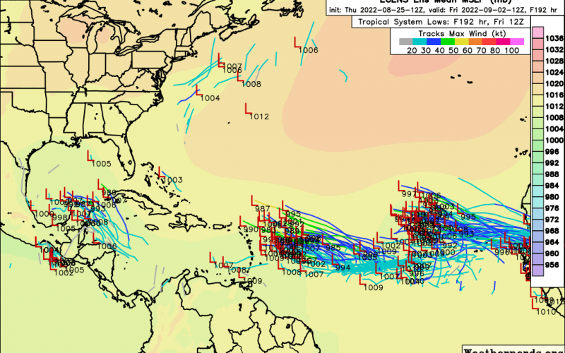
The above image is from weathernerds.org, so make sure you pay Tomer and his site a visit!
There are 3 clear areas of interest in the image above. There could be a disturbance in the Gulf around Labor Day, however the signal is not overly strong. The two waves out in the Atlantic however are on the radar. How much these waves will strengthen, or if they develop, is a big question and of course they can remain weak. The third wave coming off the coast of Africa ether could be one to watch, or it could take a path that would go out to sea.
It’s still early in the game to tell what any of these disturbances will do, if anything. We will keep watch.
Please share this article with family and friends!
You must be logged in to post a comment.