
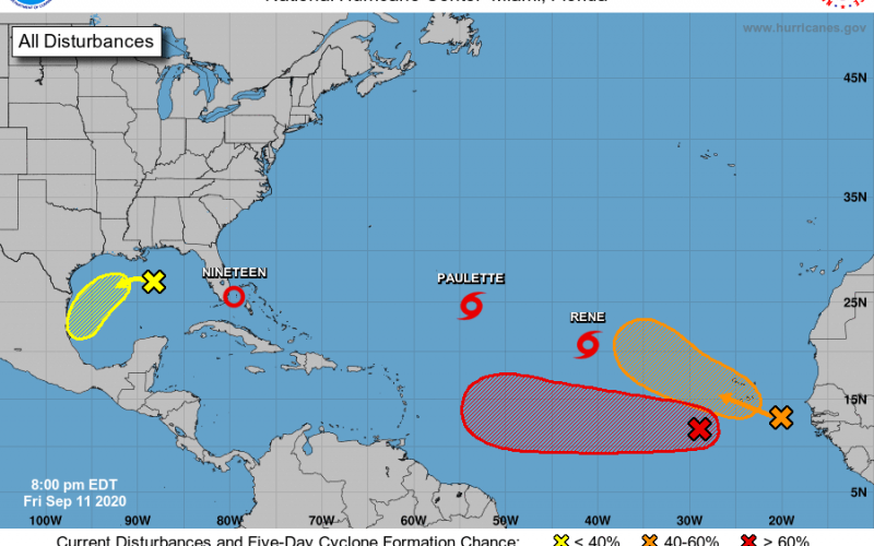
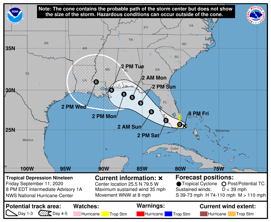
With the peak of hurricane season upon us, we are certainly seeing the activity in the Atlantic. In fact, we will soon see Sally, but she will not impact the Carolinas, but rather the Gulf Coast instead. This is currently TD# 19, which is currently near Florida. She is expected to be a tropical storm at landfall, but we would not be surprised if she made it to hurricane strength.
Elsewhere in the Atlantic, we have Paulette and Rene, which are both not expected to have any impacts with the East Coast or Gulf Coast. These two storms will likely stay or move out to sea. The orange spot has a medium chance of development over the next 5 days, however it will likely recurve and stay out to sea.

However the red spot is the one that currently has our eye, and should be watched over the next 10-14 days. The GFS had it just off the East Coast as of yesterday, however the latest run of the GFS has the storm out to sea and no impacts to the East Coast. We will monitor this storm to see if any trends in tracks become more apparent. As of now, there is nothing to go by or any reason for concern.

Thanks for reading this tropical update, and please share if you enjoyed it!
-CWA
You must be logged in to post a comment.