
6/9/2017
If we take a look at the cluster of models forecasting the Nino index, it appears that many of them have backed off the idea of a moderate to strong El Nino. If that is the case, then storminess will be less across the Equatorial Pacific, and in turn, it will allow increased storminess across much of the Eastern US. This would mean an active hurricane season, coupled with an active winter. Since air will not be rising across the Pacific as much, due to only slightly cooler than average sea-surface temperatures. This will allow for elevated convection and lifting across the Eastern US and Atlantic due to the compensation laws of physics. As long as we remain in a neutral or weak El Nino, we can expect this to be the case for the summer and winter.
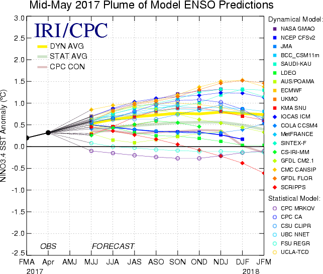
We can’t use any one model run as accurate, but rather have to see a trend, or where the models cluster. It’s around 0.5, which is a weak El Nino. A weak El Nino winter was 2009-2010, and that season was active with more than one blizzard in the East.
Mike Griffith, Meteorologist
You must be logged in to post a comment.