
6-9-2017
The magic day seems to be around the 19th, when we could see some kind of a tropical disturbance in the Gulf. The intensity of the system is not known, but it is not presently looking impressive. Shown the GFS, and if it verifies, somewhere along the Gulf Coast could see a land strike. Again this is only looking like a tropical depression. But any location could see flooding rains and stiff winds. Latest GFS:
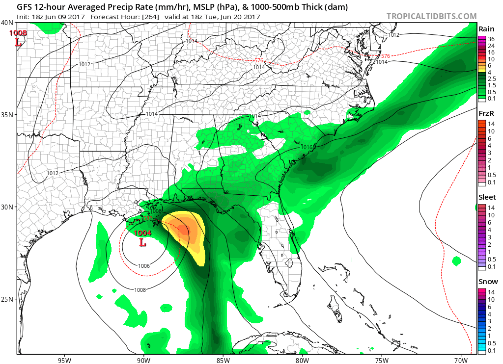
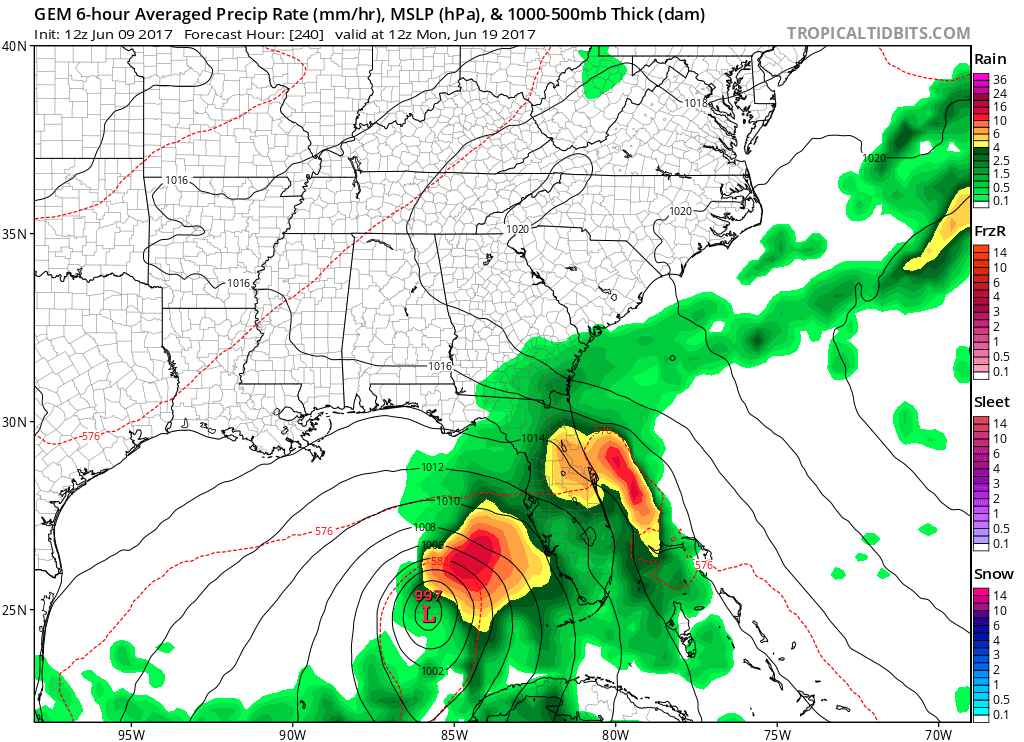
The Canadian model is a bit more aggressive, with a stronger low in the Gulf. Anybody from Florida to Texas should monitor this developing situation. It is possible that an already saturated Florida could see more rain from this system.
Mike Griffith
Meteorologist
You must be logged in to post a comment.