
Locally here in the western Carolinas, we can expect a bit more chill than the coast. Temperatures start to take a tumble late on Thursday and into Friday. By Saturday morning, we will possibly see some record low temperatures in spots. We can expect to see colder air in the mountains, as usual. Lows along the coast will only be slightly warmer. We will see the following most likely scenario shown in the map below.
This is valid for the next three days, or through the weekend.
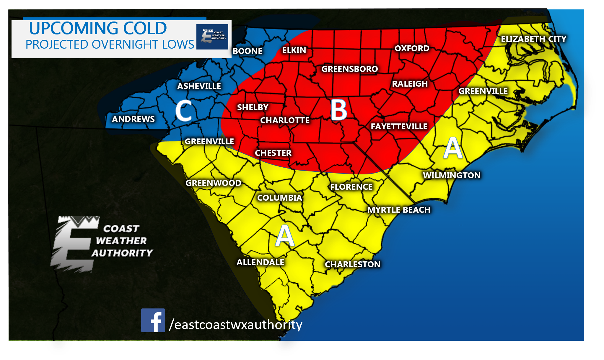
Here is the Legend for above:
A- Cold starts to move in late on Thursday, early Friday, temperatures Saturday morning 30-38 F. Warmer along the coast.
B- This is where the chill zone begins. Expecting the lowest temperatures Saturday morning, lows 25-30 F.
C- Mountains will be the coldest, with lows in the 10s and 20s a blustery nothwest wind. They could possibly see snow showers, however the air will be moisture-starved so it depends.
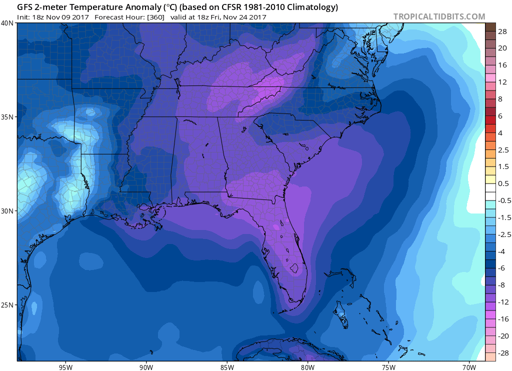
After this cold shot, we warm up slightly on Sunday. Then we start on a very temporary moderating trend, until the next shot of cold air which will be again around the 14th. But it doesn’t end there, check out our cold will could be seeing on Thanksgiving! That is a lot of well below normal cold. And yes, there is talk of a coastal storm. We may or may not see one, depending on how much moisture the potential system has to work with.
GEFS Thanksgiving Day:
It is not clear if there will be a coastal storm or not. But something we have to watch is a trough pattern in the east, which is prime for spawning coastal storms.
-Mike G.
You must be logged in to post a comment.