
A winter storm is taking shape across the South, and will continue to do so throughout today and tonight into early Saturday morning. It is currently snowing in Asheville, NC as of this post. What can the area local to Charlotte expect?
As of now, we can expect a cold rain with sleet mixed in to eventually change over to snow around 6pm or so. Areas closer to the coast will see all rain. From Norfolk down to Charleston and Savannah, all rain.
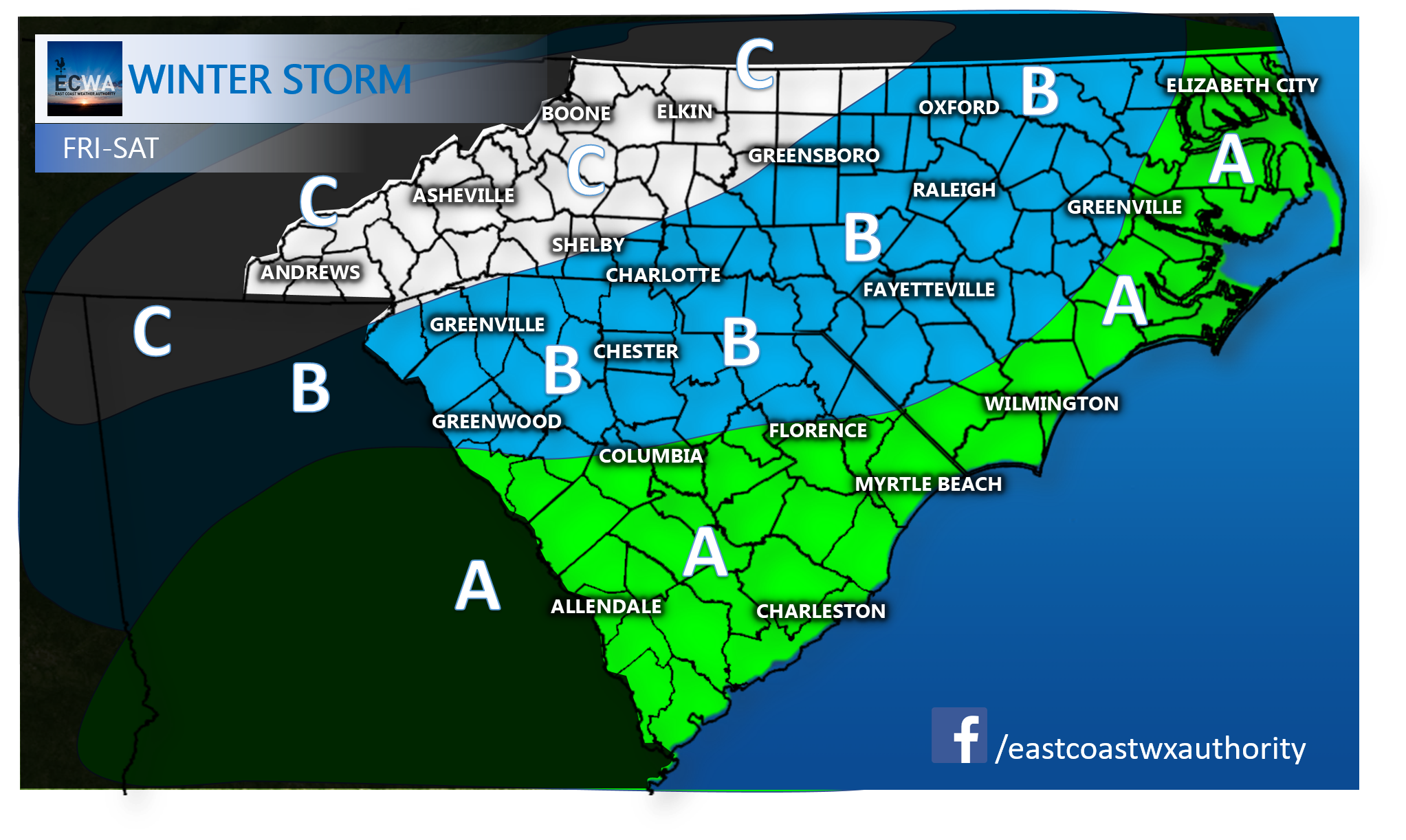
AREA A – All rain especially along the coast. No changeover to snow is expected.
AREA B- Cold rain changing over to sleet and eventually snow. Totals ranging from a dusting to an inch East, and closer to 4 inches West.
AREA C- Snow accumulations 4-10 inches. This is the area that we are expected to get hit the hardest.
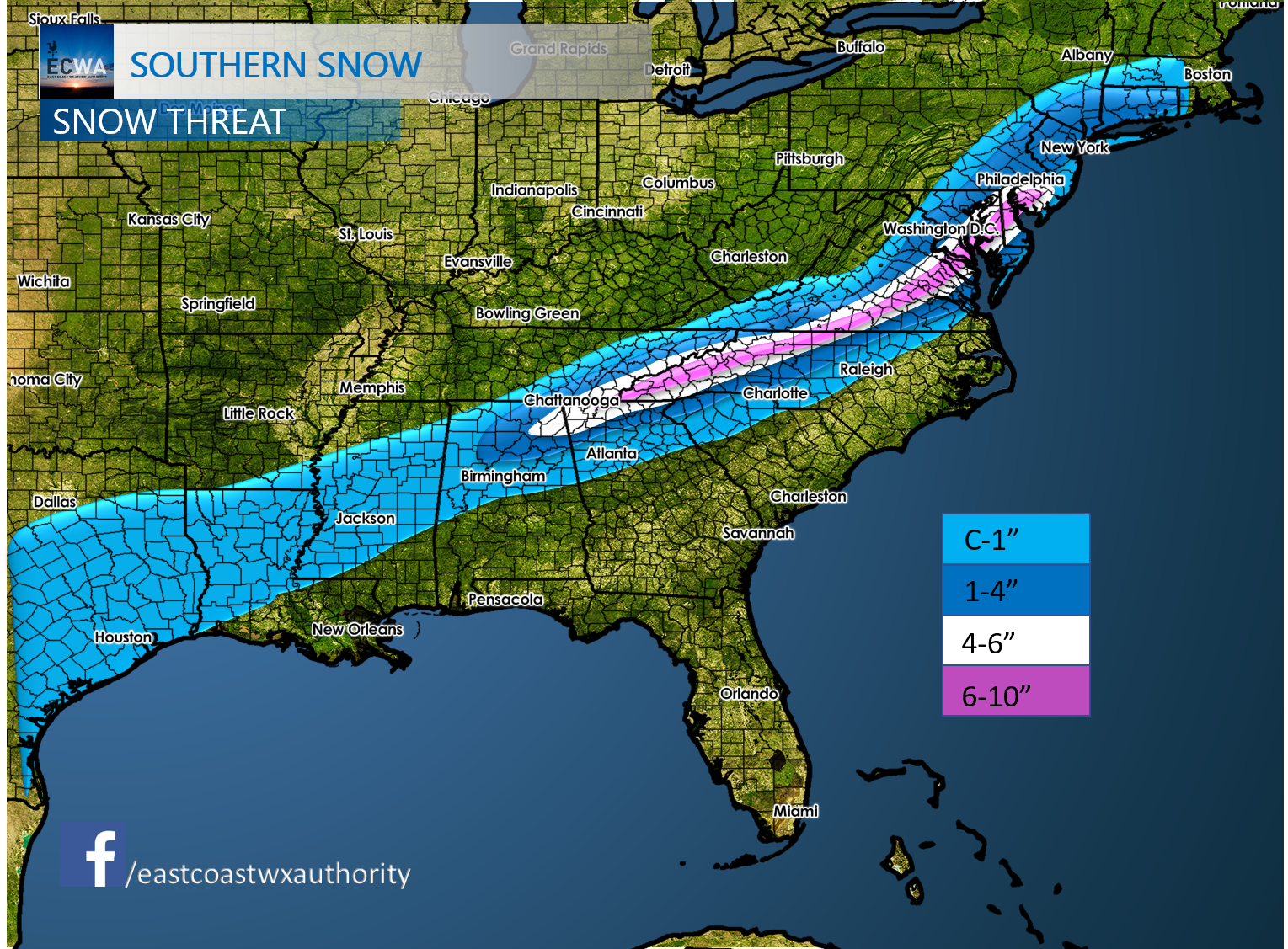
Here is the latest accumulation map:
Please stay safe and stay off the roads later today and tonight if you don’t need to be traveling. All this should push out by lunchtime on Saturday. Send pics to our Facebook page! Also check out our new winter weather page here on the site.
You must be logged in to post a comment.