
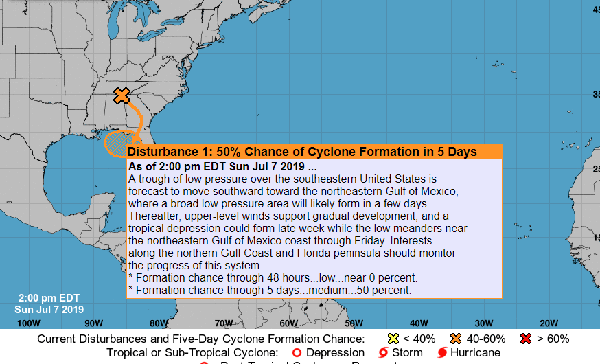
We are looking at what could be our first tropical system with impacts this season, however the extent of the impacts are unknown at this time. Currently there is a 50% chance of development in the Gulf by the NHC. The most impacted regions will be along the Gulf Coast and also inland.
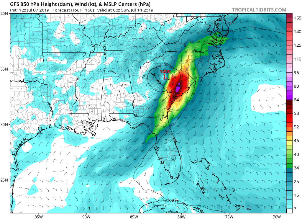
Let’s take a look at what each model is thinking. First, the GFS takes this tropical system into the Carolinas, which is what the Euro was showing a couple of days ago. This would mean a tornadic outbreak for the eastern Carolinas *IF* the GFS verifies.
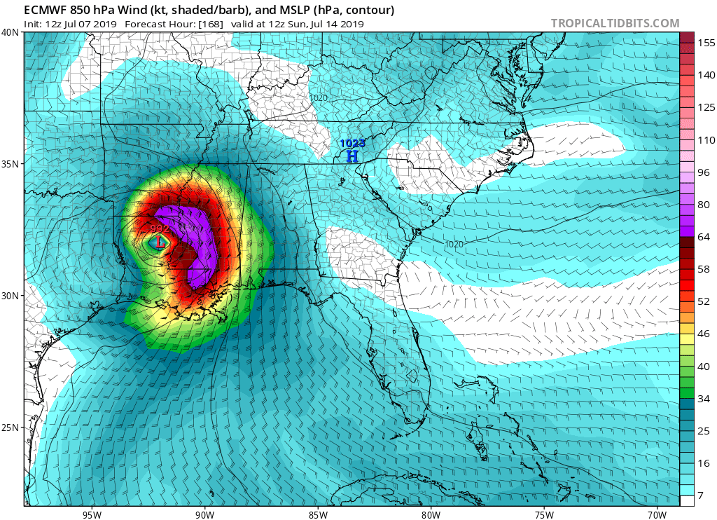
The Euro, which is deemed “king” by some, takes the tropical feature into Louisiana, which would mean little to no impacts to the Carolinas. However this would mean flooding and high winds for New Orleans.
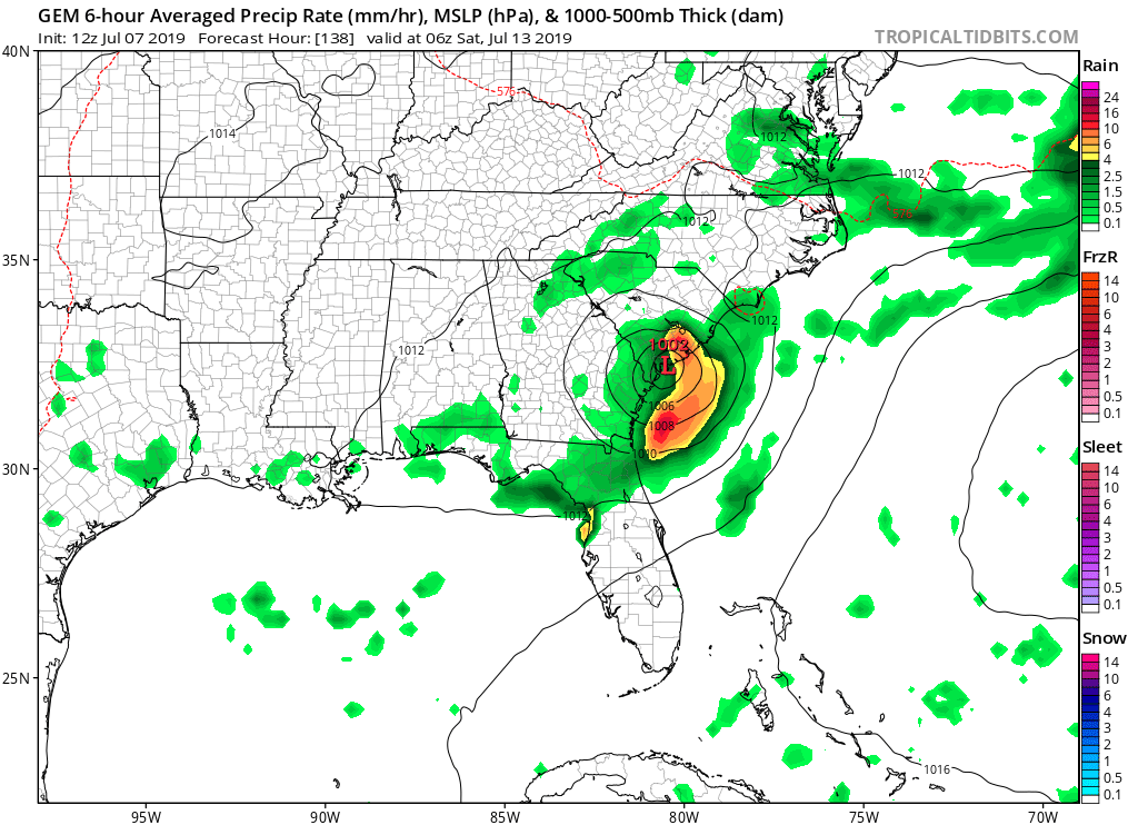
The ICON (German model) wants to take the disturbance up into Tennessee. This would mean impacts for Atlanta and anywhere on the right side of the storm which would include tornadoes, however confidence in this is low.
![]()
The Canadian model wants to hug the East Coast, right up along the Gulfstream, bringing impacts to Charleston and the Lowcountry.
Stay with us as we will continue to provide updates, and download our mobile app (currently for Android only, with plans to roll out for iOS) >>> carolinawxauthority.com/mobile-app
ECWA
You must be logged in to post a comment.