
Mother nature is keeping it active today, and the activity will continue through this week bringing a chance of rain for the southeast and more snow for the northeast. The active weather pattern is due to the ridge that has built near Greenland, not allowing storms to move northeast and into Canada, but then they force their energy to spark something along the coast.
This block has been very persistent, which helped the past coastal storm stall. As long as that block stands tall, the chance for coastal development continues because energy will be forced to the coast.
GFS 500mb Geopotential Height at 12z WED Mar 7th, 2018:
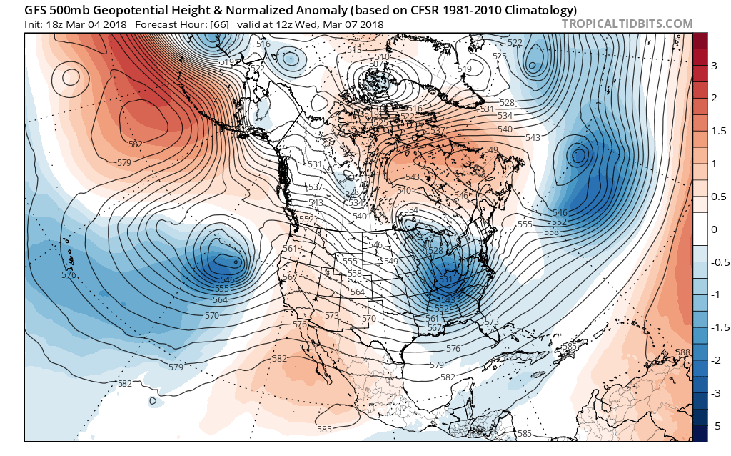
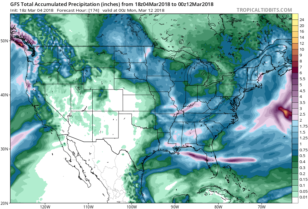
Notice the trough approaching the East coast, that trough will be associated with our next potential coastal storm and help bring wintry precipitation for the East. Snow is possible for parts of the Mid-Atlantic and the Northeast and rain looks likely for the Southeast. Finally, with this pattern, regardless of precipitation type, plenty of precipitation will be coming through the week this week.
GFS Total Accumulations. Precipitation up until 00z MON Mar 12th, 2018:
The active weather pattern will continue, so stay here with us as we acknowledge you of the latest details on what to expect!
-Alex B
You must be logged in to post a comment.