
We have already passed meteorological spring which was March 1st, and we are approaching astronomical spring which begins on March 20th, but because the calendar will be saying spring doesn’t mean the weather will feel like it right away. Through the past week the east coast experienced a nor’easter and they are going to be gearing up for yet another wintry mess, but will the pattern change for the start of Spring?
For the past week we have experienced average to slightly above average temperatures across the east with the exception of when our big nor’easter slammed the east coast with heavy snow and strong winds. With the next storm that is coming by temperature across the east will be below average as the next storm will drag down some below average temperatures.
GEFS 2m Temp Anomaly for 00z FRI March 9th, 2018 :
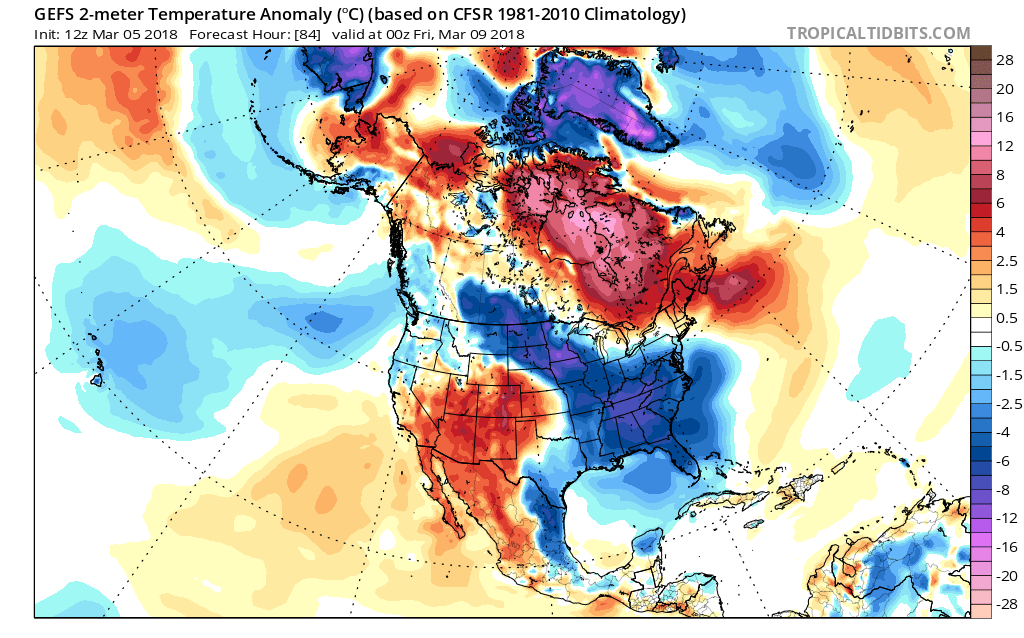
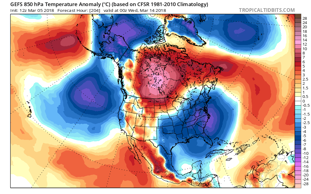
Cold air will be filtering into the east from the central US as energy is pushed to the coast with the next storm that will effect the east coast Wednesday through Thursday. Looking at next week expect below average temperatures to continue as we have good agreement on cold air being stuck in place across the Eastern US with the two main global models.
GEFS 850hPa Temp Anomaly for 00z WED March 14th, 2018:
EPS 850hPa Temp Anomaly for 00z WED March 14th, 2018:
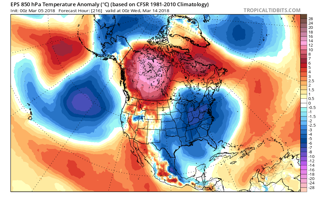
Notice the similarities between the two global models, almost identical. This as forecasters, especially when forecasting for medium to long range, gives us confidence in that next week will turn out to be above average. When will we break out of below average though?
Right now it looks like we will snap out it by the time spring is supposed to astronomically start.
GEFS 850hPa
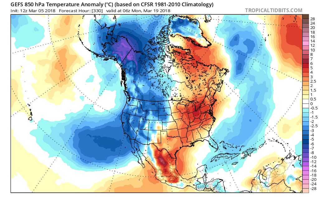
This is two weeks out from today, and notice that the ensembles are showing a warm up period to begin that week. Does that verify to what the upper levels show though?
GEFS 500mb Geopotential Height Anomaly for 00z SUN March 18th, 2018:
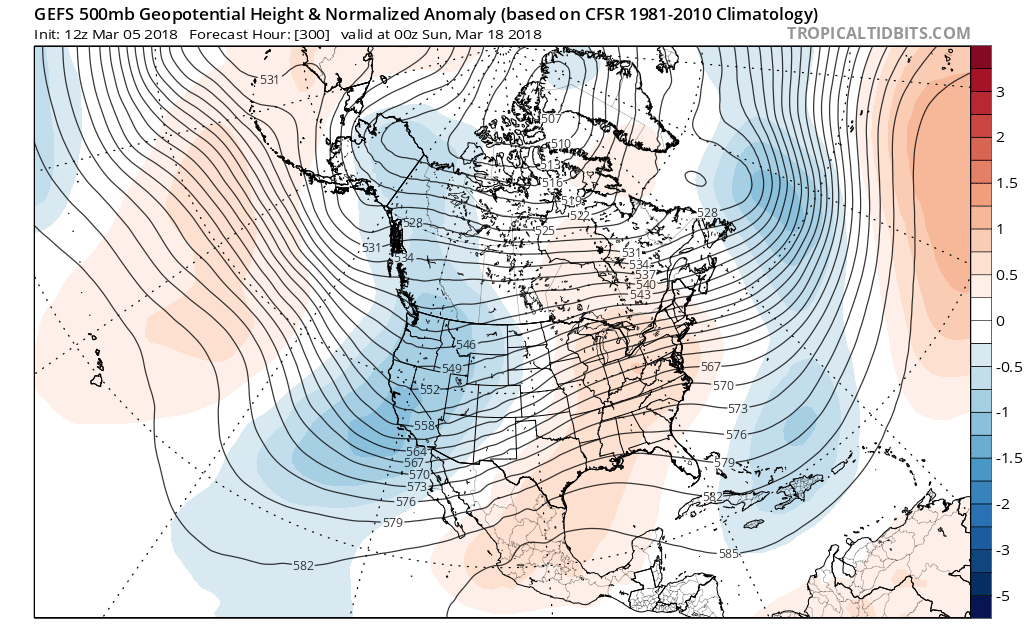
Notice that there is a ridge in place over the eastern US and the ridge near Greenland has decayed. One thing we are to watch though is that these global models tend to lean back to climatological averages near the end of their runs, but one thing to look forward to is that after the next two weeks of winter like feels we will break out! Stay here with us as we prepare you for any warm ups or cold downs down the road.
-Alex B
You must be logged in to post a comment.