
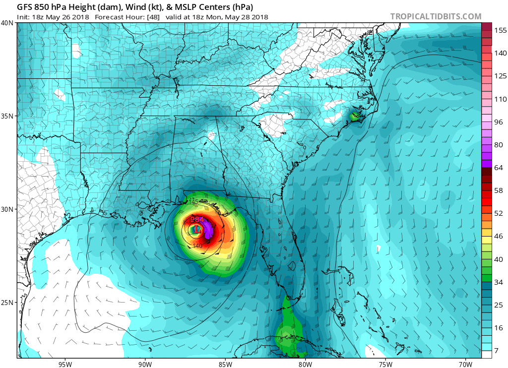
Alberto will likely intensify over the next 24 hours. He could make it to category 1 hurricane just before making landfall, especially if he slows down. This would be around 1pm on Monday. Ensembles are tightening up for a landfall somewhere between Pensacola and coastal Alabama. Watches and warnings have been posted for tropical storm conditions. Even though this storm is classified as subtropical due to having multiple areas of center circulation, tropical storm warnings have been posted along the western side of FL and also the Panhandle.

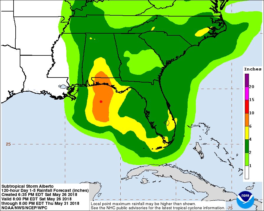
Tropical storm warnings extend to the AL/MS state line. Coastal MS is under a tropical storm watch. This storm is expected to move onshore by the NHC, and then head north. However, rain from Alberto’s outer rain bands will affect the entire Southeast. Much of the lowcountry will experience between 2-4 inches of rain before Alberto dissipates.
The forecast is growing in confidence as the ensemble plots are tightening up on a path for Alberto. This storm’s path will be fairly well known unless drastic things happen at the last minute before landfall. The Gulf Coast from MS to FL needs to monitor this situation closely!
-Mike Griffith
Meteorologist
Sign up for our premium blog and email just 65.00 a year or 5.50 a month >>> Subscription Options
You must be logged in to post a comment.