
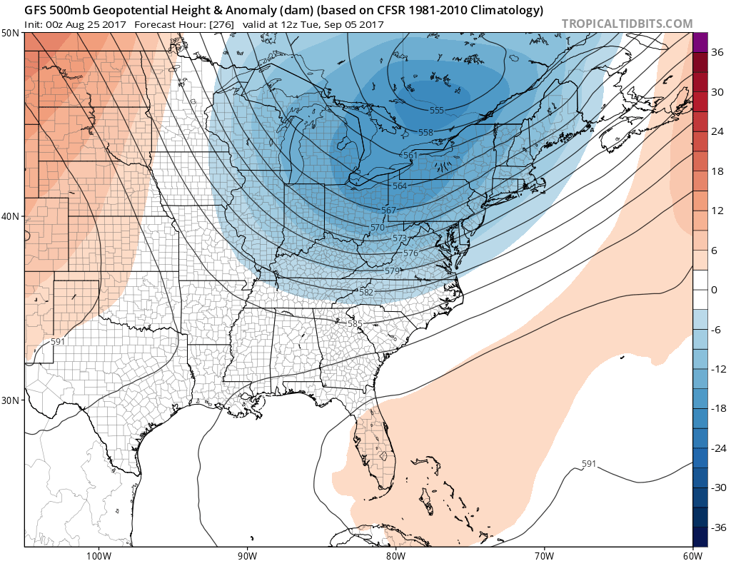
Looking into the first week of September, the GFS is showing another large-scale trough over the Eastern US and Mid-Atlantic around September 5th. This would mean either storminess or below-average temperatures, or both. The 500mb height anomalies are showing this feature.
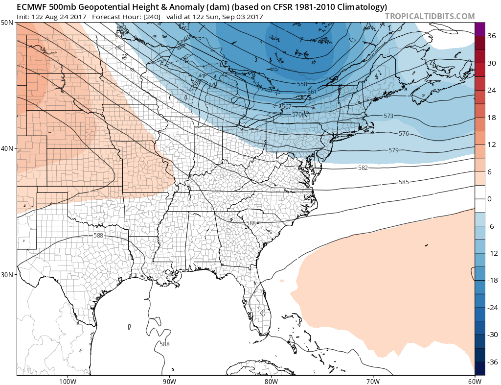
The Euro, which is not matching the GFS exactly, is indicating a similar feature around September 3rd, although since it is 2 days before, is not quite as strong. However, there is an availability of cold air around the 3rd-5th which will likely make it’s way into the Eastern US. This would be a refreshing fall-like airmass with high temperatures in the 70s for the Northeast.
GFS temperature departure from normal on September 6th:
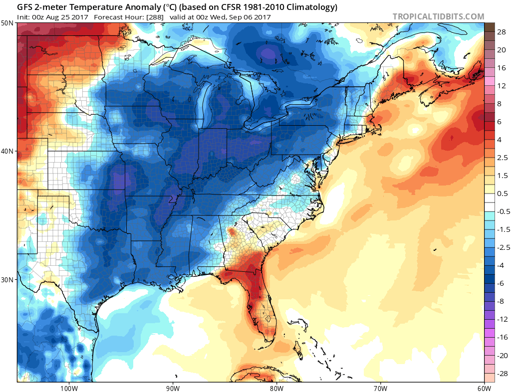
Looks like 100 degree temperatures are OVER for the year! It will be very hard to get any pronounced heatwaves after September 1st since the daylight hours start to decrease. For now, start thinking FALL!
You must be logged in to post a comment.