
POTENTIAL “HUMBERTO” MAY POSE THREAT TO THE SOUTHEAST THIS WEEKEND INTO NEXT WEEK
If there’s anything to be taken away from this tropical season, it’s that the Atlantic is keeping us on our toes. If the evolution of Dorian wasn’t shocking enough, our latest item of interest has went from being barely conversational, to being another potential tropical threat for the Southeast!
Potential Tropical Cyclone Nine has is becoming better organized and will likely reach tropical depression status overnight tonight into early tomorrow before strengthening to a tropical storm on Saturday. A Tropical Storm Warning is already in place for the northern Bahamas, adding insult to injury with the recent devastation of Dorian. Once even tropical depression status is reached, the cyclone will receive the name Humberto.
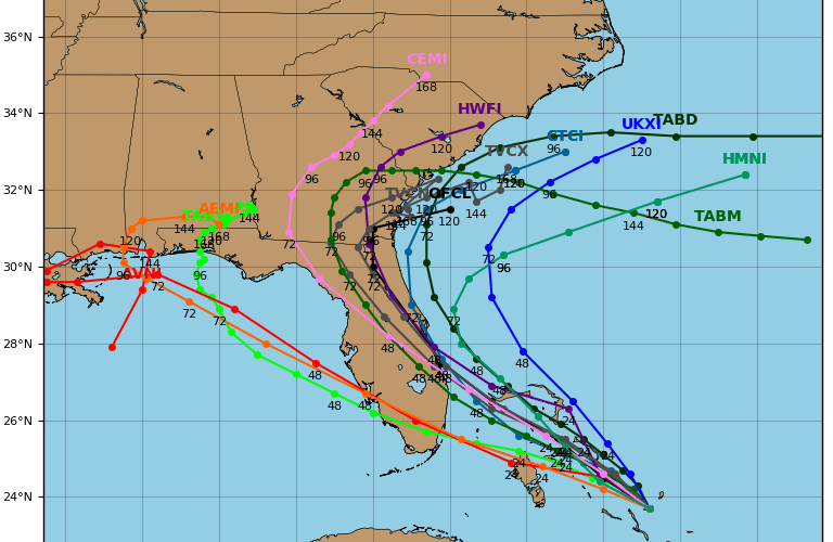
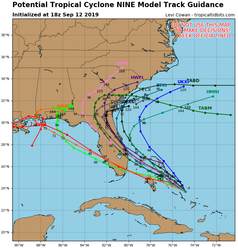
From there our model data begins to grow rather cloudy and inconsistent in solutions for the track of the cyclone toward the Southeast US. Originally, expectations were for a track toward the Gulf Coast, and that still remains in the realm of possibilities according to some modeling. The reason for concern however, resides in the notion that much of the modeling begin to trend the track of the cyclone much further east in last night and today’s runs. This creates quite the variety of outcomes ranging from a track toward the Gulf, to inland over Florida, to just off the Southeast Coast, and even just a re-curvature out to sea. Take a look at the range in 18z model guidance this evening:
The latest cone outlook issued from The National Hurricane Center has the cyclone reaching the East Florida Coast as a tropical storm on Saturday, followed by a weakening over land to a tropical depression which begins to impact the Carolinas around Tuesday. Right now, the discussion from the NHC states that the model range is fairly high, “even higher than usual” the forecaster stated.
This means that timing, intensity, and track can easily change. We could be looking at anything from a weak tropical cyclone, to something considerably more ominous with model fluctuations over the next few days. They will certainly continue. What is on the table? Let’s take a look:
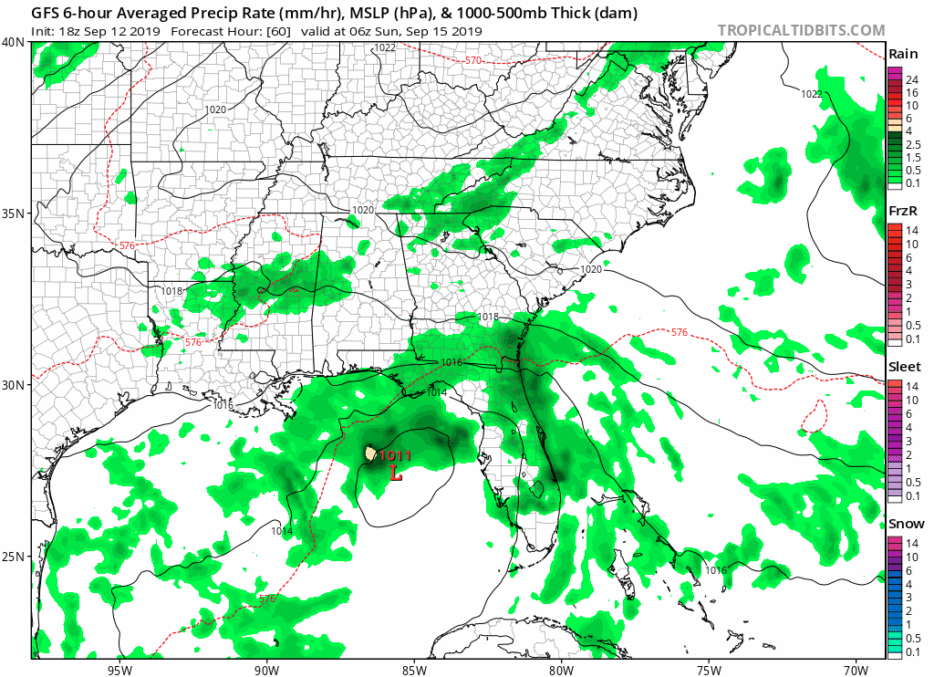
The best-case scenario would likely be something similar to the 18z GFS solution, (shown above) which takes a more westward track with a weaker system and results in some harmless and beneficial rain showers to parts of the Carolinas, particularly South Carolina early next week.
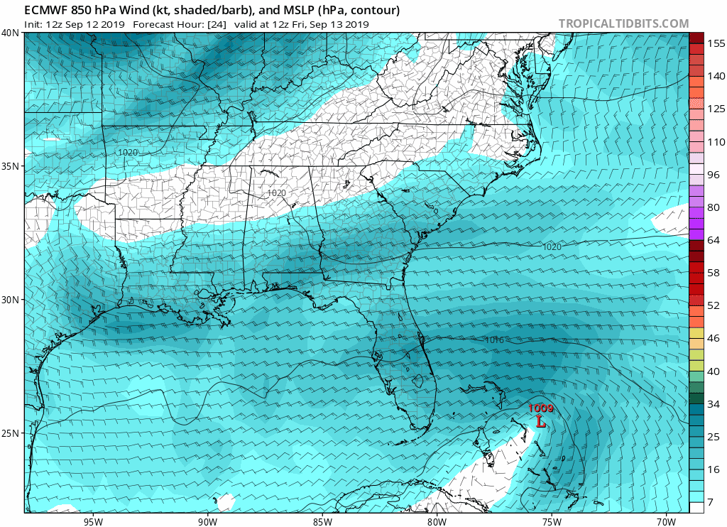
Another solution is the European 12z model run which keeps the cyclone slightly offshore Florida, and then takes it out to sea to stall, and develops it into a major hurricane. The track is considerably away from the Carolina coast, but if this solution were to verify, albeit more west, we might have another hurricane on our hands. That is NOT a forecast right now, but that is something we need to watch. ***Note: The upper level wind map is shown here due to precipitation outputs being unavailable for the European Model from Tropical Tidbits.***
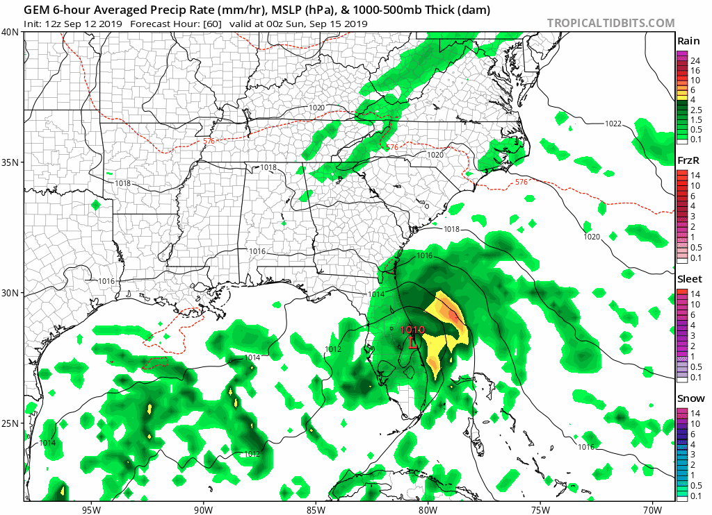
The 12z Canadian model run shows a stall of the cyclone on or just off the Carolina coast for days resulting in extended torrential rainfall and major flooding concerns, even inland.
To be honest, all of this is only model discussion right now and not a forecast. There’s quite a wide variety of potential outcomes for potential tropical cyclone Humberto. The best thing you can do right now is not to panic, but just to stay tuned for the latest from Carolina Weather Authority on our Facebook and Twitter pages, as well as here on the site. We’re also keeping a close watch on another feature further east in the Atlantic that could be an issue downstream. We’re taking this season one cyclone at a time, but make sure to stay tuned on that item as well in the days to come. We have also added a lot of content to our models page. Be sure to check that out. https://carolinawxauthority.com/models Here, you can access the latest modeling, satellite imagery, and NHC forecasts at your own convenience. Stay tuned!
-Jesse
Carolina Weather Authority
You must be logged in to post a comment.