
For those of you who are sick of the heat in the Southeast, relief is on the way, but it won’t come overnight. In fact, in the days ahead, it will seem as if summer will never end. Well technically, it still is summer. That doesn’t go away until the 23rd when it’s officially fall. But after the official arrival of Autumn, we could see some seriously chilly air in the Southeast. The big question is, does it happen, and also will the cold air make it all the way to the Southeast?
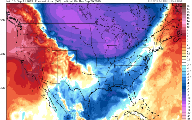
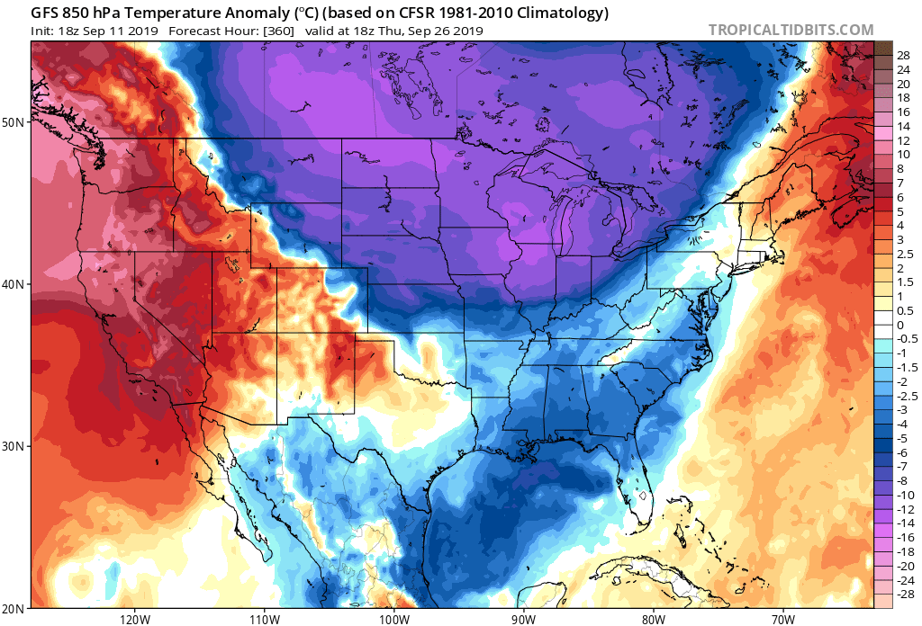
The GFS is hinting at a big pattern change next week. I don’t think it’s handling the extent of the cooler air very well, and I think it will spill farther east. This would mean morning lows in the 50s for the Carolinas, and lower temperatures in the mountains. If the cold does arrive, it would be late next week.
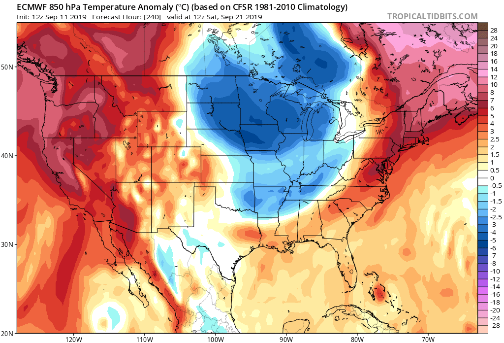
The Canadian and Euro models are not as drastic with the cold, however they do both indicate a trend towards a cooler airmass next week. The Euro below is hinting at a strong cold front that could work it’s way though this Saturday. This could be only one in a series of cold fronts, and the major blast will be the one next week.
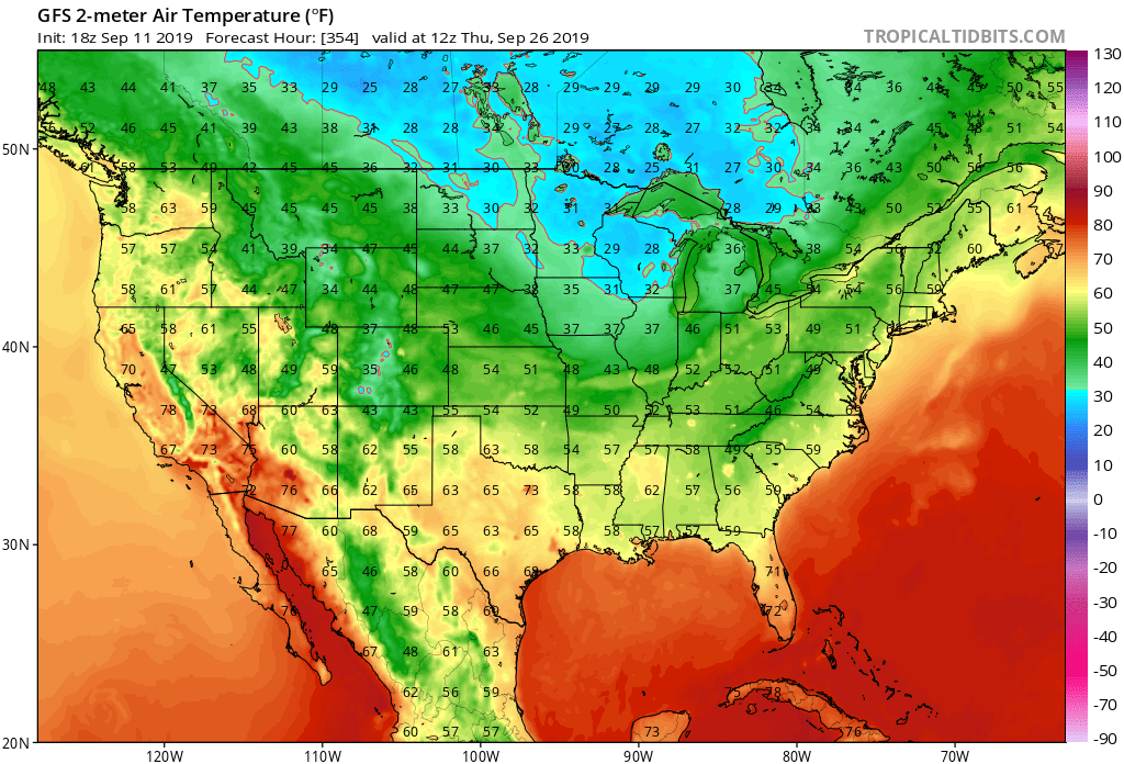
What are the temperatures looking like on the GFS? Morning lows will be in the 50s for much of the Carolinas, and in the 40s in the mountains. This would be textbook fall weather for the South. Below are GFS temperatures for Thursday next week.
This is only one model run and is not a guarantee, however this is a welcome trend given the recent heat! Some of us would prefer not to sweat as soon as we step outside.
Stay tuned and please share!
-CWA
You must be logged in to post a comment.