
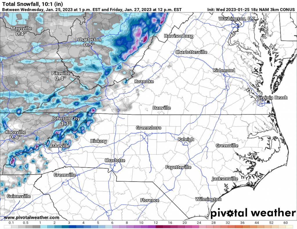
The moutains will receive more snow tonight as conditions turn windy and colder. When colder air moves in from the northwest, the air is forced up the mountains and snow results. There could be some decent accumulations, but that would be in the higher elevations.
The valleys may not see much at all, except for some flakes depending on location. This seems to be the pattern we are in, rain for the Piedmont and then mountain snow events as it gets windy and cold behind each departing system.
Below is the NAM model showing total snow from tonight into early Friday morning:
Elsewhere across the Piedmont, it will be turning windy tonight with scattered power outages, so be sure to charge phones and anything that runs on a battery. Thursday will be colder and windy. The coldest morning will be Friday with widespread lows in the 20s.
See our other article for those details: Turning Colder; More Mountain Snow
You must be logged in to post a comment.