
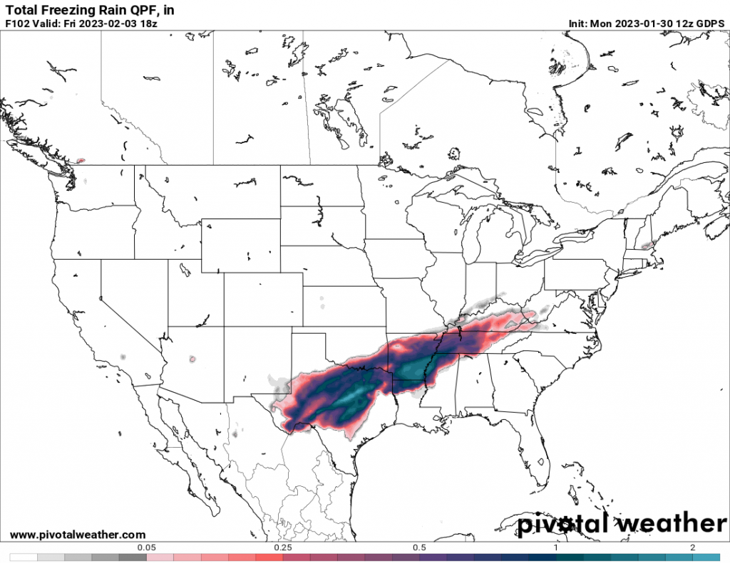
It will feel warm outside for much of this week for the Southeast, and we should be grateful, since to our west a major ice storm is underway in Texas and into the lower Midwest and Plains. Keep tabs on Texas ice over the next 2-3 days as flights will likely be canceled and travel impossible on the interstates. it’s looking nasty.
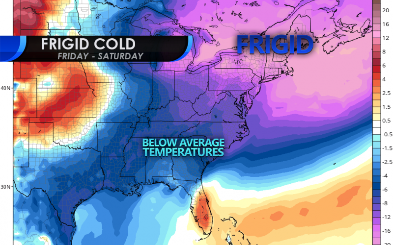
But in our neck of the woods, we will see some brief cold later this week after a chance of rain each day this week. Saturday sunrise is shown below on the Euro.
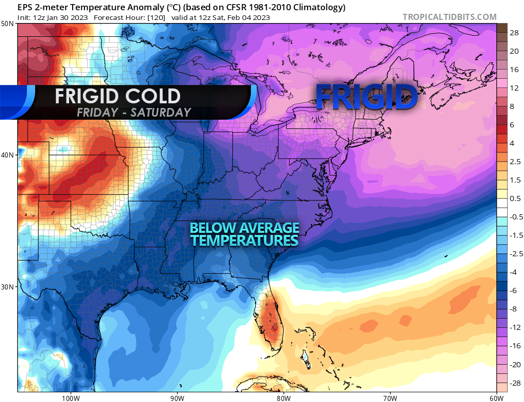
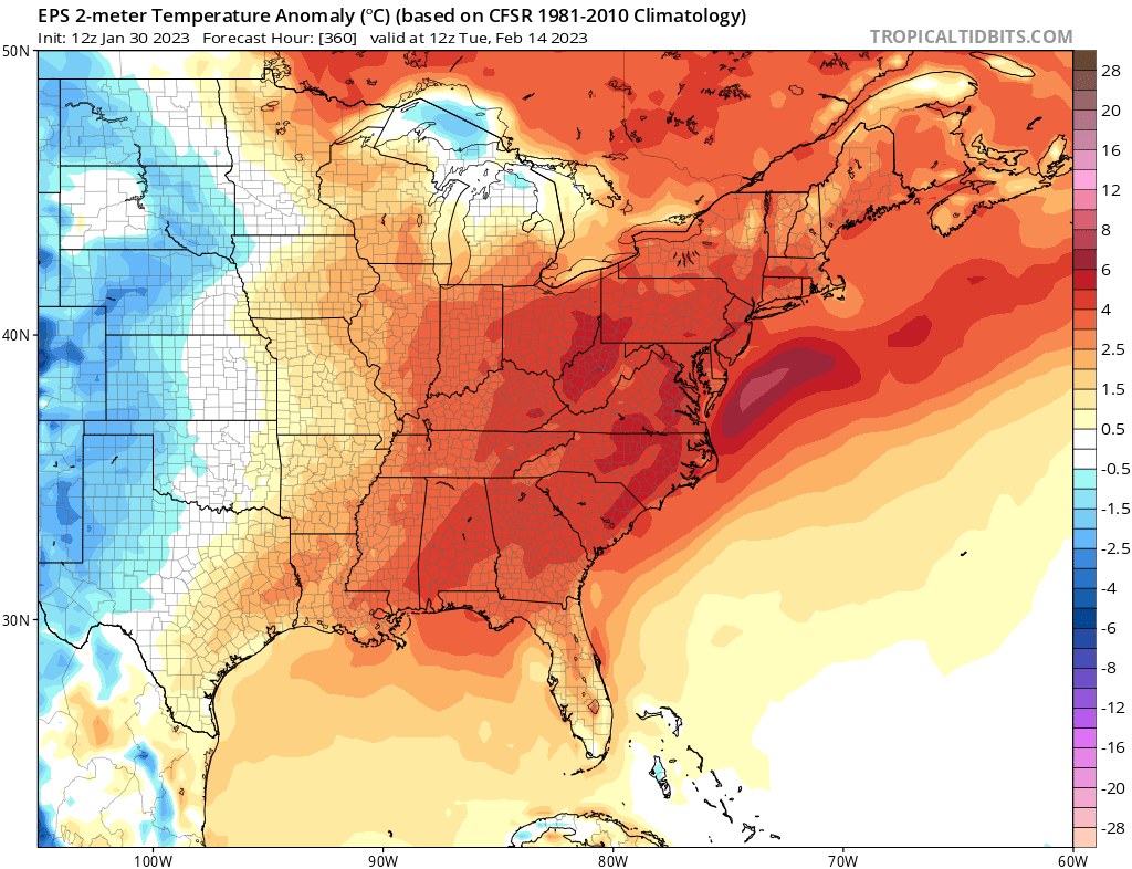
The Northeast will see the most brutal cold, with lows in the -10s and even -20s. This will be a transient shot of cold for them and also for us. It won’t stick around. It’s our only shot of cold before we warm right up again, and this time for the foreseeable future perhaps into mid February.
For some reason, this winter reminds me of 2018-19, but we didn’t have a winter storm this time in December, but rather that severe cold wave.
Below is the Euro ensemble mean for Valentine’s Day, and it looks red with love. But not love for snow and cold lovers, not that kind of love.
Be sure to also follow us on Twitter! Please share this article to inform family and friends on social media.
You must be logged in to post a comment.