
The North Carolina State Climate Office has completed their April 2020 Climate summary. If you remember, the month of March was very warm. In fact, all monitoring stations in NC recorded their 5th or 6th warmest March on record. I remember fearing that Summer had come early. Thankfully, April turned out to be very Spring-like. Here’s a look at the highlights from the report, which you can read in its entirety here.
Cool Temperatures Dominated
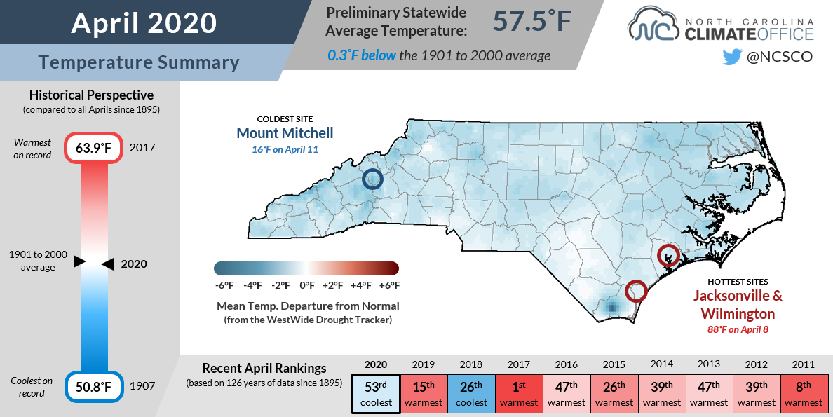
After a very toasty March, April saw a return of cool spring temperatures. The average temperature for the state during April was 57.5°F, ranking as the 53rd coolest April in 126 years. The coldest temperature recorded was 16°F at Mount Mitchell on April 11th. The warmest temperature was 88°F at Jacksonville & Wilmington on April 8th. In reality, the temperatures were only slightly below the 99 year average. but it sure was nice to have an long Spring!
April 2020 Climate Summary – Precipitation
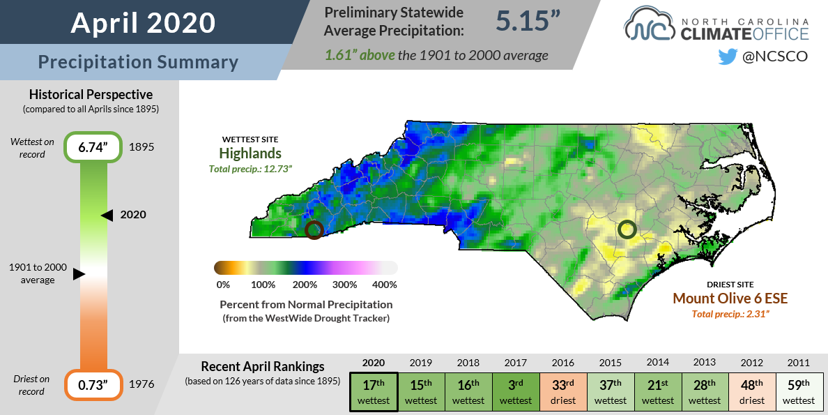
Besides being on the cool side, April was wet and stormy. The average amount of precipitation received statewide was 5.15″ (1.61″ above the average). The driest spot was Mount Olive with only 2.31″ of rain. The heavy hitter for rain was in Highlands with 12.73 inches! April was much wetter than average, coming in as the 17th wettest April in 126 years of record keeping.
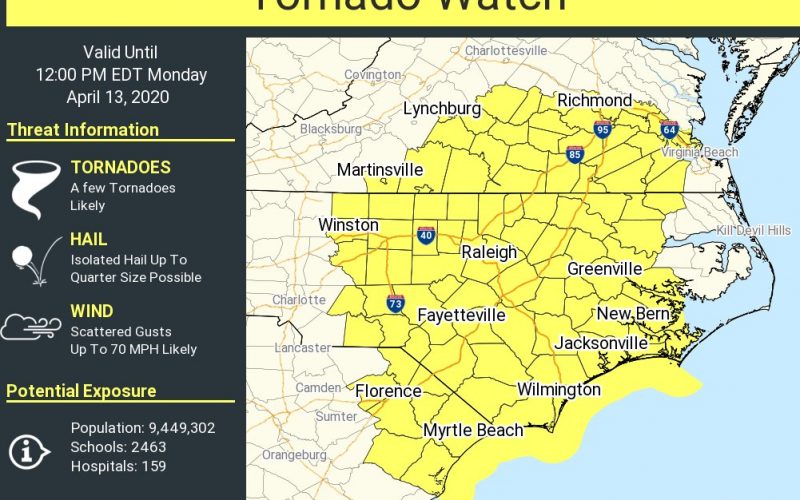
April 2020 Climate Summary – Severe Weather
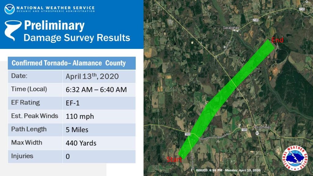
The April 2020 Climate Summary also includes a report on severe weather. The tornado outbreak responsible for widespread damage in the Deep South on Easter Sunday continued into North Carolina the morning of Monday, April 13th. In Alamance County, the map below shows the path of an EF-1 tornado from April 13th at 6:32am. Thankfully, no fatalities were recorded.
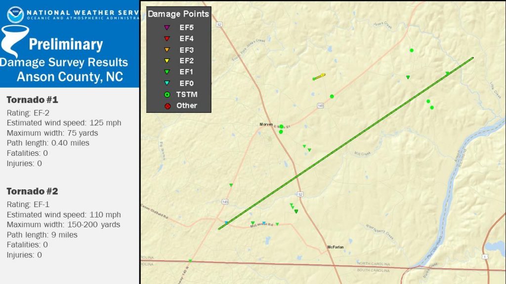
In addition, two tornadoes were confirmed in Anson County. An EF-1 tornado carved out a path 9 miles long and 150-200 yards in width at its widest. A much shorter but more powerful EF-2 tornado ran for half a mile with maximum winds of 125 mph.
If you have a great weather story from April 2020, be sure to share it in the comment section below!
Want to know what June will bring? Be sure to check out our model page for all the latest guidance! Be sure to check out our Facebook Page where you can always get updated when a new post appears on the website.
You must be logged in to post a comment.