
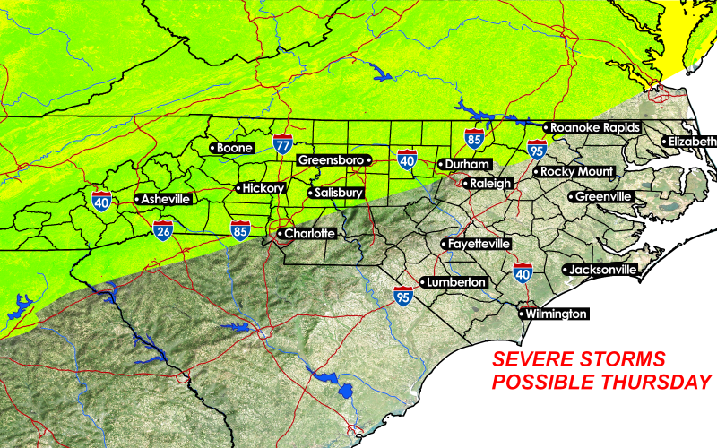
A cold front responsible for a multi-day outbreak of severe weather in the Midwest this week will drop south into the Mid-Atlantic states later Thursday. Along and ahead of it, lines of thunderstorms are likely to develop, tapping into the hottest (low to mid 90s) conditions we’ve had in 2020. Storms could produce widespread wind damage in the afternoon across the northwestern portion of North Carolina as well as much of Virginia.
Storms could survive into the Piedmont and SE Virginia region during the evening, interrupting outdoor activities in places like Greensboro, Richmond, and Raleigh. Some locally heavy rainfall is also possible from any storms, though they should be moving fairly steadily across the region. Many places still need to dry out from the deluge we had in the second half of May, and rivers are still running high.
Currently the Storm Prediction Center is forecasting a marginal (1 out of 5) risk for severe weather, but we at CWA believe there could be upgrades coming.
You must be logged in to post a comment.