
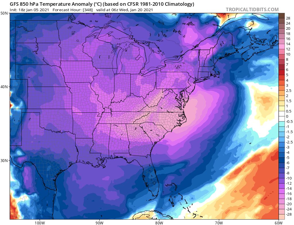
As we are watching our winter storm for Friday, a perhaps bigger deal for many will be the widespread icy cold that is supposed to head our way perhaps as early as next week. The month of January will certainly finish much colder than in started, especially in the Southeast. Below is the temperature anomalies at 5,000 feet in the atmosphere according to the GFS. That is quite the bone chilling look, especially for the Carolinas.
This is due to the Polar Vortex weakening, and sending a “chunk” of it down into North America. This is happening right now, and the effects usually take about 8-13 days after. So we are looking at around the 20th or so, perhaps a few days or a couple days sooner. Currently, blocking high pressure well to our north in Canada is keeping an active storm track over the Southeast. That’s why our winter storm chances are favorable in the coming weeks.
Below is the current stratospheric warming event, which weakens the Polar Vortex and allows it to break apart and send chunks over certain continents. There is a blue lobe that has been broken off and parked over North America.

The effects will not be felt immediately, but rather in 8-13 days. That would mean around the 13-18th for us, which seems accurate since the first model image above is for 1/20.
Get those scarves, winter coats, and hats ready because there will be a time when we will all need them, perhaps down to the Florida- Georgia state line. See what I did there? (I really don’t care for country music, btw).
Please help us out and share our articles!
You must be logged in to post a comment.