
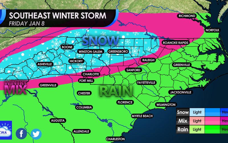
All eyes are on Friday as a storm system skates across the Southern US this week. Amounts will be widely unknown as this is still a low confidence forecast. However confidence is increasing for snow over western NC and parts of northern NC. Outside of this area expect sleet to possibly mix with flakes, or mix with rain in the pink area. Anywhere else especially farther south can expect all rain. There is not an abundant source of cold air so this storm will have to “make” its own air by means of dynamic cooling, or precipitation falling through the atmosphere which cools it off, and then becomes cold enough for snow.
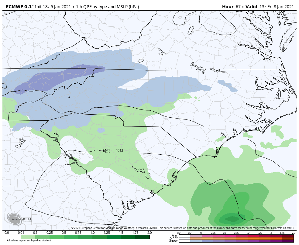
The storm is expected to arrive during the early morning hours on Friday, between 4 and 8 am. Below is the Euro showing wintry precipitation spreading across western NC and the Upstate of SC. According to the Euro it does not look like a heavy snow event, but it is still too early to tell all the details.
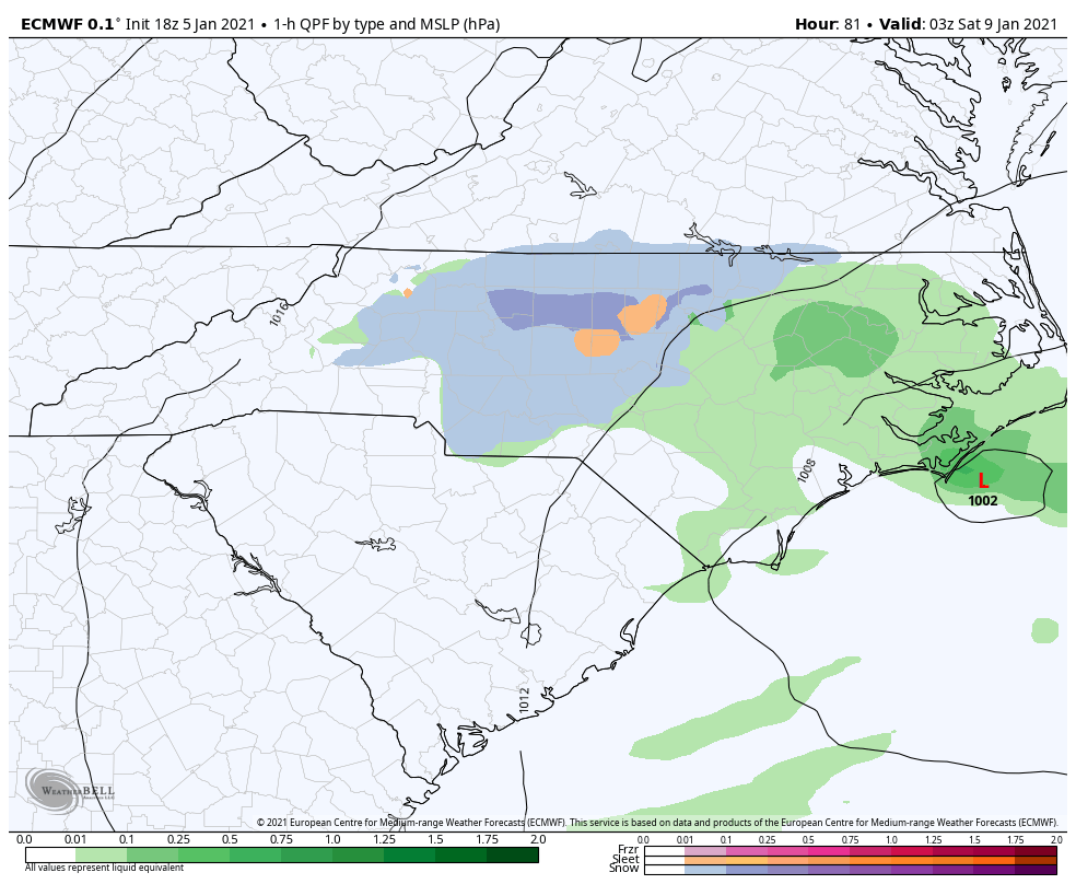
By Friday night, the storm moves east, and rain/sleet could change over to snow briefly before ending from west to east. Again this does not look like a major event since the ground will be relatively warm. And there is uncertainty about any location getting heavier snow due to banding, since we are not sure where that will set up.
That’s all for now, thanks for reading this update and please share!
You must be logged in to post a comment.