
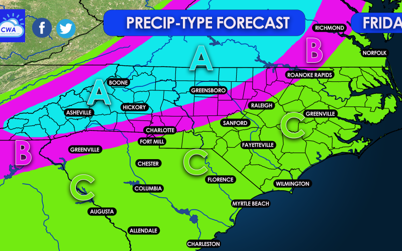
There has been a lot of buzz around social media for some potential Southeast snow on Friday. While some locations will receive some, it’s not expected to be a widespread event outside of the mountains. However we never know with these types of systems in the Southeast, and with blocking in place (favorable upper-air pattern), this storm could go either way as far as snow amounts. But for now, we are expecting sleet from Greenville through Charlotte, and may follow the I-85 corridor to Raleigh and even up to Richmond. Snow is possible outside of the mountains, but will be in its usual place more north and west. Of course, we will update if snow trends more south and east.
See the legend below the map for what kind of precipitation type(s) to expect in your area:
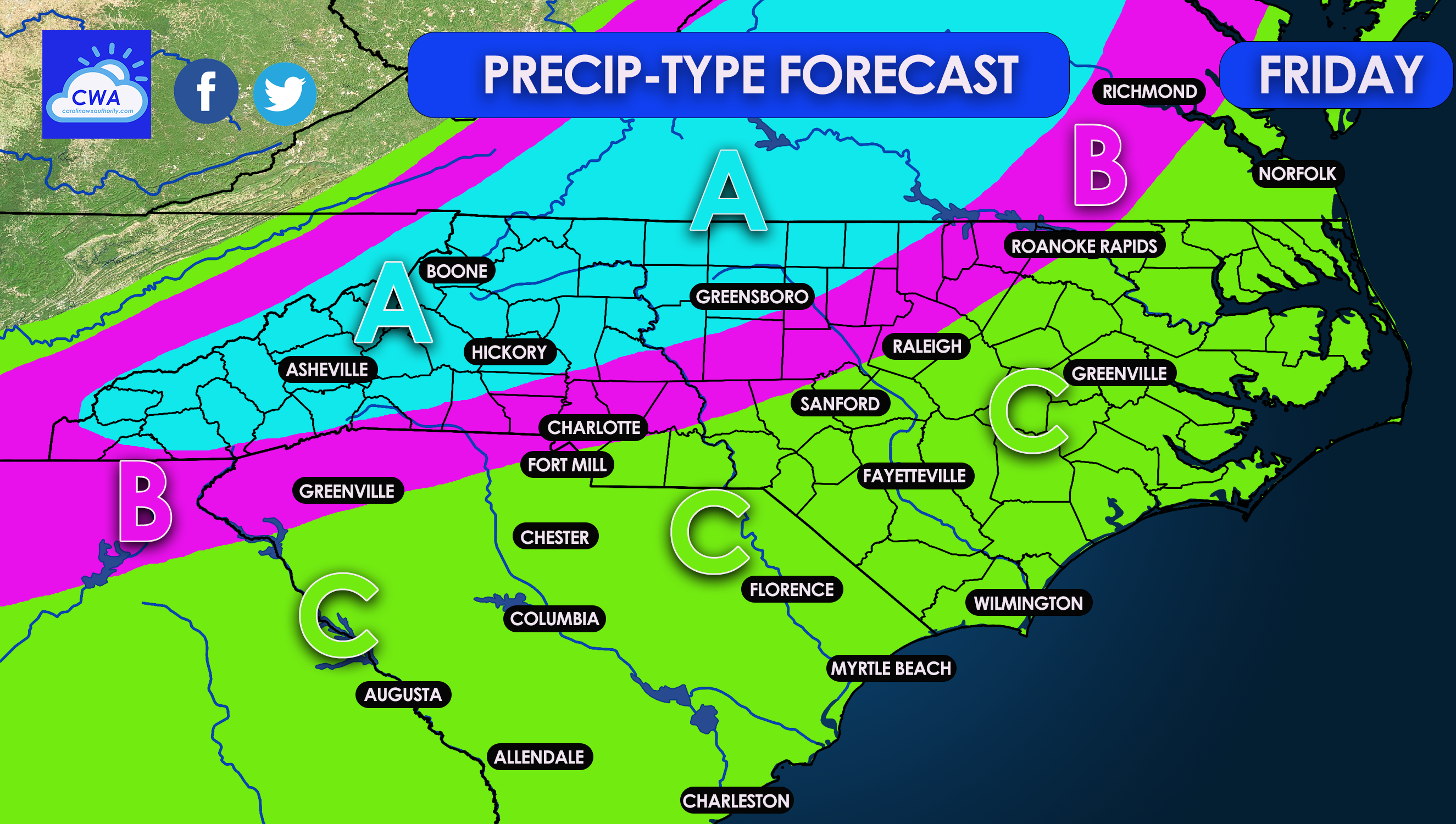
AREA A: This area is expected to be mainly snow but could mix with sleet at times, including the onset. There may be limited accumulations outside of the mountains, but this area is most likely to see flakes.
AREA B: This could be a sleet party. Not a lot of snow accumulation is expected, if any. Sleet could mix with rain at times and even snow at times. This is not expected to be a significant event for this area. However some sidewalks and road surfaces could become slick.
AREA C: All rain, too warm for any kind of frozen precipitation.
We will monitor this event as it gets closer and will provide updates. Remember, it’s hard to get snow in the Carolinas, so this forecast could trend more towards rain. But we will watch the trends and make adjustments as necessary, even if it means expanding the snow area!
You must be logged in to post a comment.