
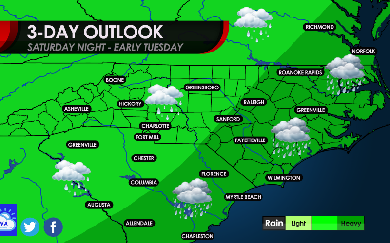
TONIGHT SATURDAY NIGHT….Rain will overspread the region later this afternoon and tonight, and will be heavy at times and steady near the coast. It will be a warner day and evening, with the humidity starting to increase. Many of us can expect highs in the 50s and low 60s today.
SUNDAY… The rain tapers off and it will be dry, although clouds could linger. Highs again will be in the 50s and 60s.
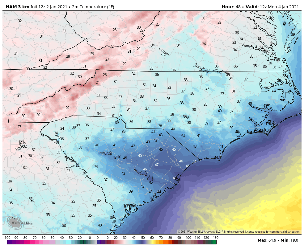
MONDAY…Looking like a chilly wake-up with morning lows in the 30s for many. Another dry day is expected.
Monday am temperatures – click for larger version
EXTENDED OUTLOOK…We are expecting a pattern change starting around January 8th as the upper-air pattern will be in a “blocking” regime. This means that storm systems will cut under the large area of high pressure in Canada, and will head our way. However these storm systems will be accompanied by Pacific air, so there is really no source of Arctic air. The only way a storm could put down some flakes if it is a cut-off low and is strong enough to generate its own cold air or “bring” cold air with it, which is very possible in the upcoming pattern.
We did put out an article saying cold and active pattern but did not guarantee snow. But the train of storms about to cut across the Southern U.S. starting on the 8th looks interesting.
You must be logged in to post a comment.