
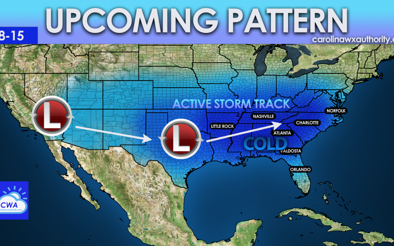
As we ring in the New Year, the overall pattern will start to shift. As we are now stuck in low clouds and fog, temperatures have hovered right around normal for this time of year for the Carolinas, perhaps a bit warmer along the coast. However, a week from today, January 8th and on things could turn interesting in the way of a colder pattern. It also appears that the storminess will continue, and it could in a persistent fashion with multiple areas of low pressure moving across the southern U.S.

It’s too early to say if this will be rain or snow for us, but as of now all we can say is stormy with below normal temperatures. This simply could just mean that it will be cold for once in mid January. There is a lot of chatter around social media about a high latitude “blocking” event, which signifies and an active storm track for the Southeast. The below Euro ensemble map shows the red in Canada which is “blocking” high pressure, and that will be one of the causes for our pattern change here across the South.
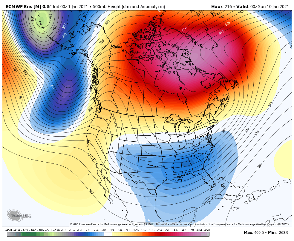
This is basically the pattern you want to see if you want snow. However, the models have to remain consistent with this trend, and not lose this pattern to a ridge. But we are seeing consistency, which reinforces the idea of an upcoming colder pattern.
We are not shouting “snow” by any means, but are bringing attention to a colder and more “active” pattern, even if that means rain.
Please continue to follow us on FB for all the updates, and be sure to like us if you haven’t already >>> https://www.facebook.com/carolinawxauthority
You must be logged in to post a comment.