
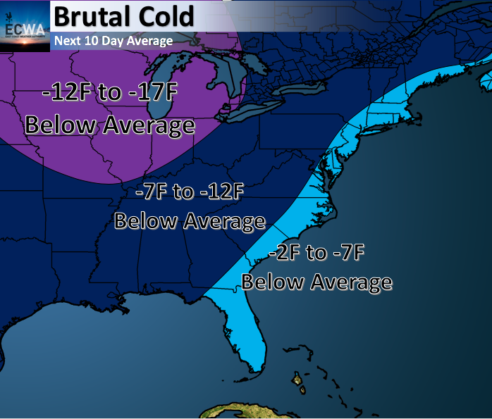
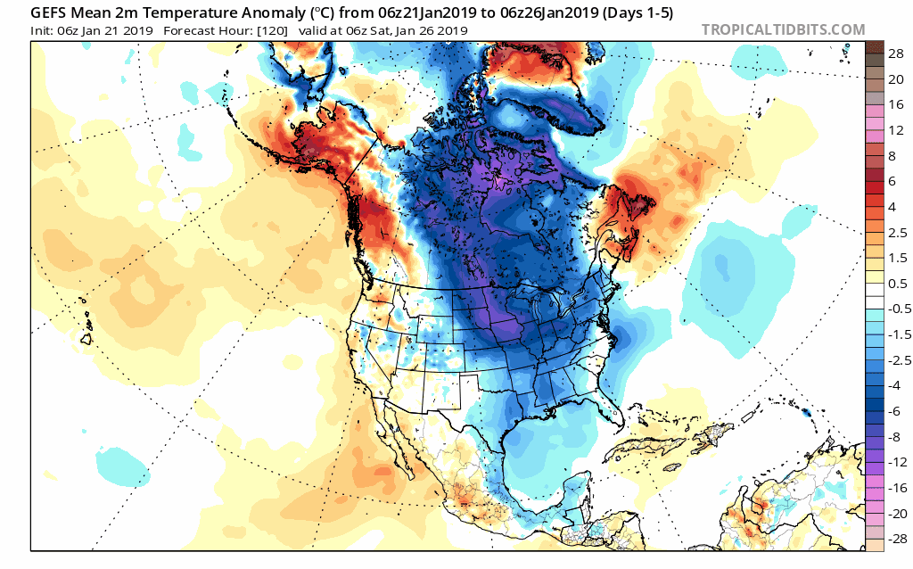
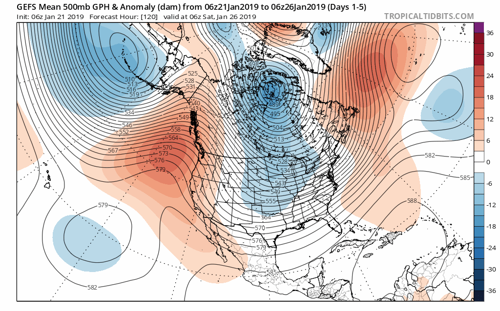
Our pattern flip is underway, and the arctic air is in place along the Eastern US. This pattern is here to stay, with temperatures much below average. Here is how cold we are expecting it to be over the next 10 days:
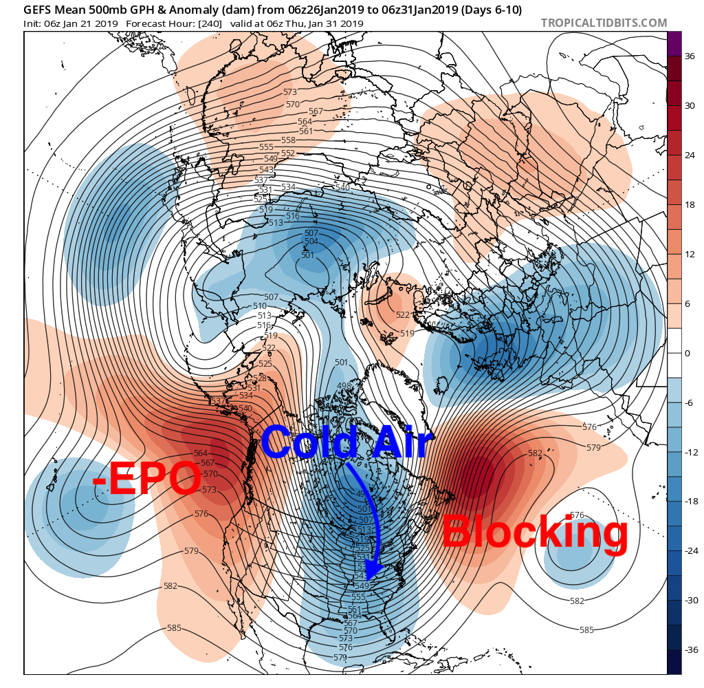
We are expecting this cold pattern to continue into February and models are showing this outcome as well.
With high latitude blocking, the trough in the Eastern US will continue to persist allowing shots of arctic air to flood the region. Also, a negative EPO creates a ridge near Alaska allowing cold arctic air to flood the region as well.
This pattern will also lead to the increase threat of storminess along the East Coast so make sure you continue to follow along with us here at East Coast Weather Authority.
-Alex B.
You must be logged in to post a comment.