
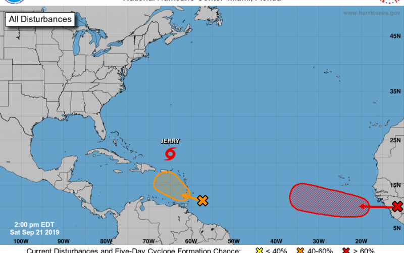
The tropics are anything but quiet right now. We are currently tracking Jerry, which will likely impact Bermuda next week. They do not need another hurricane since Humberto just recently hit parts of the island. Jerry is expected to weaken and also turn north over the next 5 days or so. He will not be a threat to the mainland US.
The disturbance in orange has a 50% chance of formation over the next 5 days, which we may have to keep an eye on. This disturbance is forecast to turn north according to models. However, if the ridge of high pressure moving in is strong enough, this system may either track more west or more northeast. It is still too early to tell.
The disturbance in red coming off the coast of Africa has a 90% chance of formation over the next 5 days. Indications are that this disturbance will start to head a bit more northwest than west. If this system does in fact develop into a tropical storm and then a hurricane, it was be a Cape Verde-type hurricane. These definitely have to be watched. Nothing is guaranteed in the tropics, as intensity and tracks can always change with little to no notice. We will be watching and will provide updates as things change!
Please check our site for updates and check out our NEW models page! https://carolinawxauthority.com/models
-CWA

You must be logged in to post a comment.