

After a rough evening across the Piedmont Thursday night, some drier air gave most of the Carolinas a chance to dry out, but coastal areas remained wet to end the week. Unfortunately the wet weather is expected to continue to jeopardize outdoor plans over the weekend as a front remains stalled near the coast. Additional daily rainfall amounts of 1-2 inches will be common for both days of the weekend along the coast, especially north of Charleston.
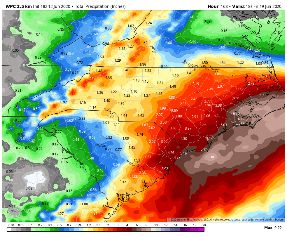
Official forecasts from NOAA through next Friday show widespread amounts of 3-6 inches of rain as low pressure forms along what’s left of the front. A trough of low pressure will continue to feed moisture up the coast and provide plenty of clouds and more waves of rain Sunday through at least Wednesday of next week. While the official forecast amounts top out at 6-8 inches in the Outer Banks, some forecast models show the potential for double-digit rainfall. The mountains will also be quite unsettled as the trough cuts off over the western Carolinas.
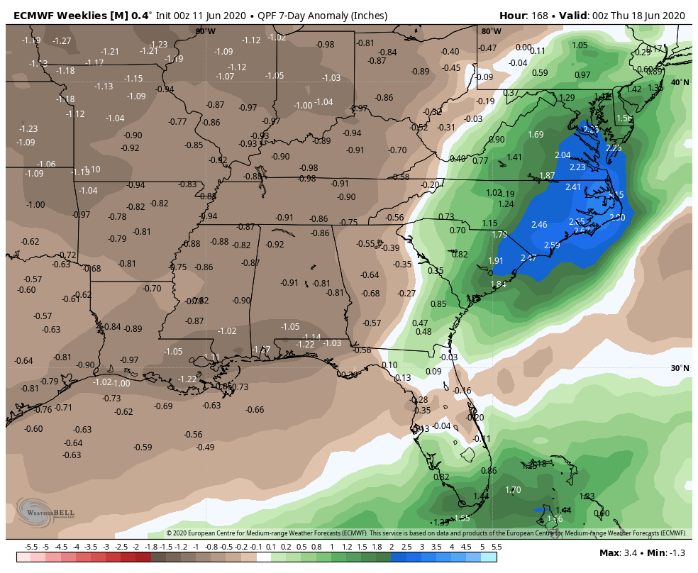
Not only will rain spoil plans this weekend into next, but some places will pick up more than 3 inches more than average, as shown above by the European model. This would put the eastern Carolinas as the wettest spot in the country, just as they were during the last 15 days of May. If the pace continues, some places could have their wettest 60 period day on record. While this goes in line with our wet forecast for the summer, it could be even more extreme than anticipated.
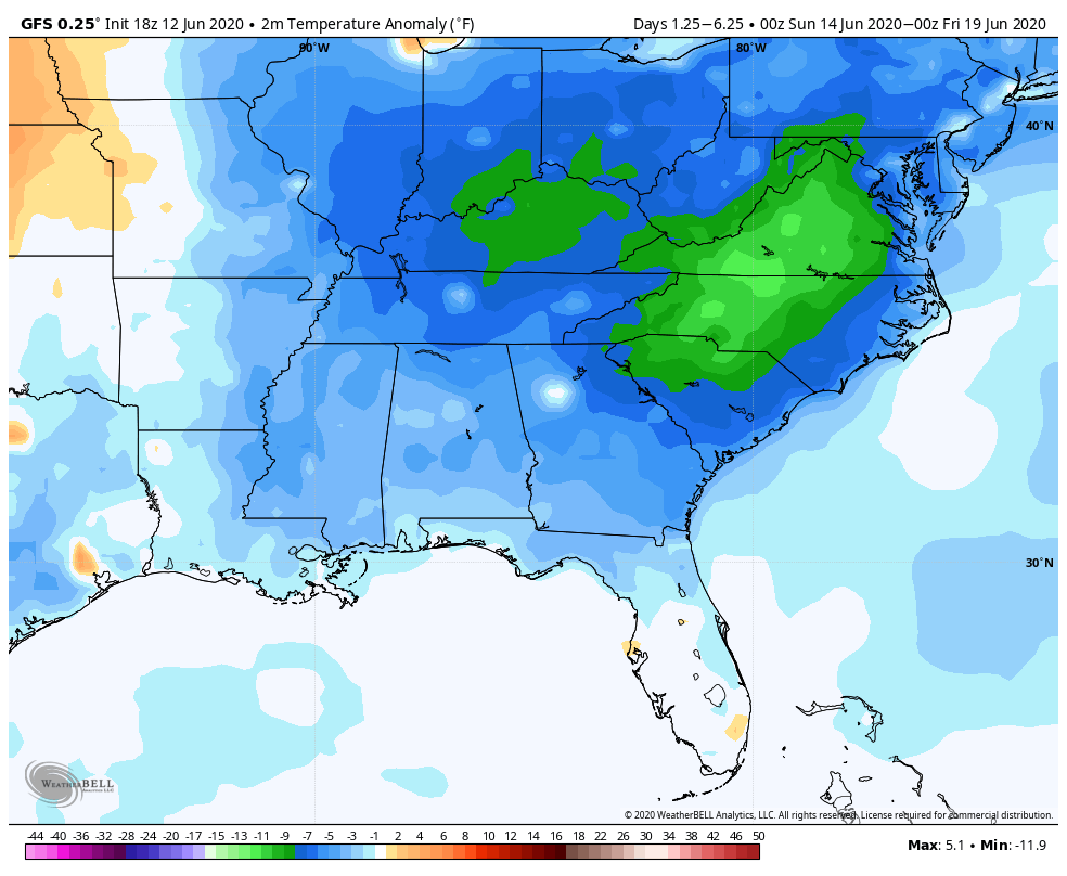
The cut off upper level low will bring down cool air from the north, but cloud cover and precipitation will keep temperatures running well below average, by perhaps as much as 12 degrees over the next five days in the northwest Piedmont and up into the Shenandoah Valley. This means a few days next week may have highs in the 60s, if that. At least we should see some savings on our electric cooling bills!
For now the tropics remain quiet, but with low pressure stalled off the Carolina coast, we still need to keep a close eye on in-close development as the Gulf Stream remains warmer than average. At the very least, some gusty winds could cause coastal flooding in the normally prone spots.
You must be logged in to post a comment.