
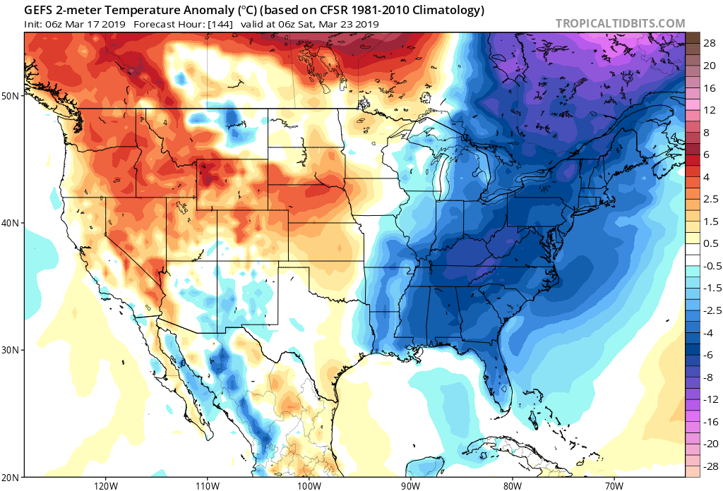
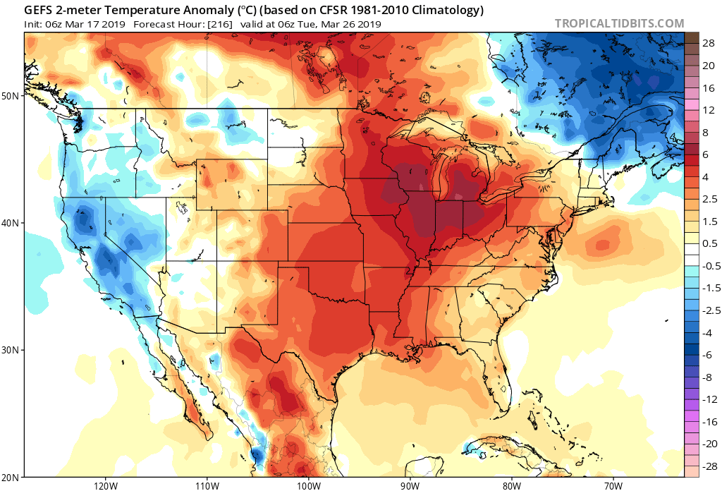
BELOW NORMAL TREND OVER THE NEXT 7 DAYS THEN WARM
Currently we are in a chilly pattern here along the East Coast, and will be for the foreseeable future until a shift to spring happens sometime around the 24th or 25th. Below is what we can expect until the 23rd 2nd image:
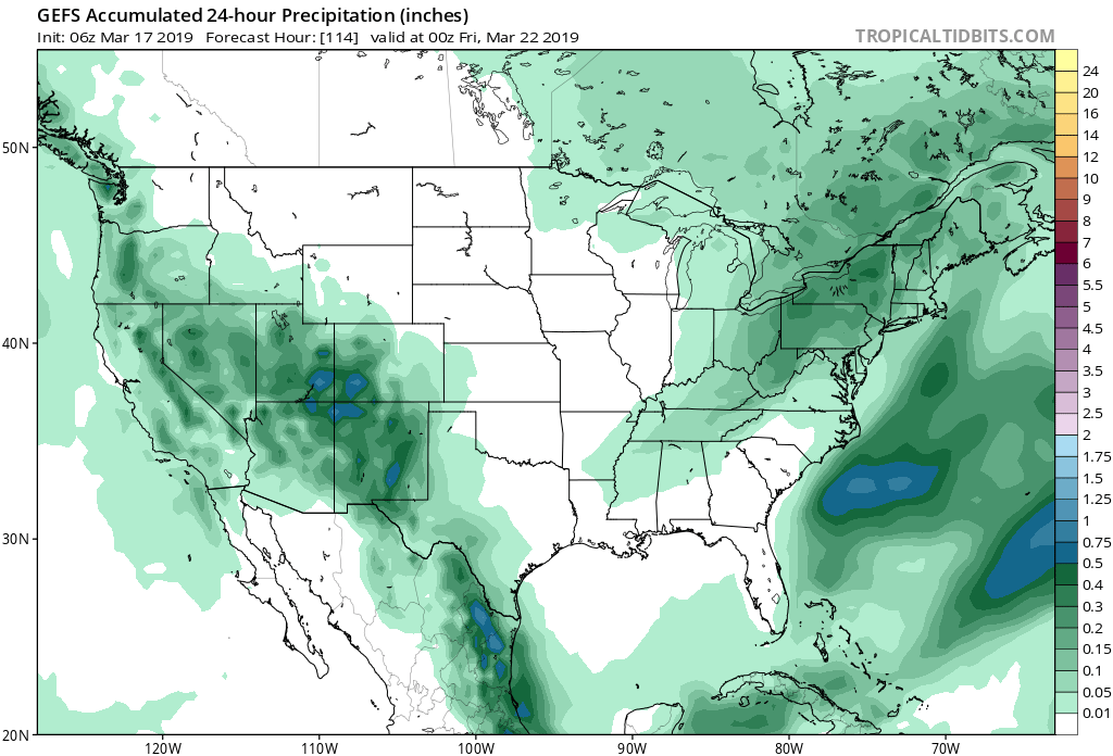
NEXT RAIN CHANCES:
The next chance for rain arrives later this week, around Thursday into Friday.
However, a shift does occur and the sun will be out across the Midwest. The very NICE WEATHER may make it into the Southeast as we could be DRY!
70s and maybe even in the 80s in spots already, and it’s just turning spring.
Who wants a long hot summer or who wants winter until August? Comment below!
-ECWA
You must be logged in to post a comment.