
As many of us may know, the weather is in for a drastic change this weekend. We are looking at a very cold air mass over the eastern US by Sunday morning. Temperatures in many locations could dip into the teens (10s). Many mountain locations will be the coldest.
The GEFS ensembles are catching on to the upcoming cold shot. This is for Sunday evening around 8pm. Of course, this might not be exactly what happens unless this verifies. What are we looking at for Sunday? Well below average temperatures.
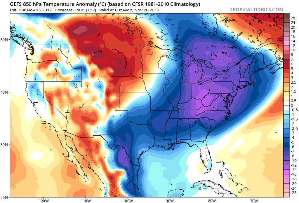
Temperatures on Monday morning will be the coldest. Nighttime lows will dip into the 10s and 20s for many. Notice all that cold up in Canada! Single digits. That is extremely impressive for this time of year. That tells us that repeated cold shots are loading.

However, please note, these GEFS ensemble forecast temps are NOT what we are expecting. The ensembles are too warm. Temperatures will be colder than first expected. Again, we are expecting nighttime lows to dip into the 10s and 20 for many. 30s closer to the coast.
At any rate, this Sunday and Monday will be cold. Prepare for sub-freezing conditions this weekend, especially at night and into the early morning.
-Mike G.
Follow us on Facebook >>> https://www.facebook.com/eastcoastwxauthority
You must be logged in to post a comment.