
There is the potential for some wintry precip across Southeast PA on Monday, as much of the air south of PA will be too warm. The current threat is ice and sleet with snow in far northern interior locations.

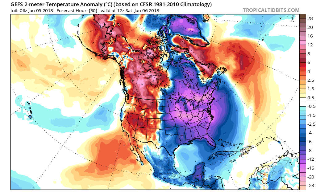
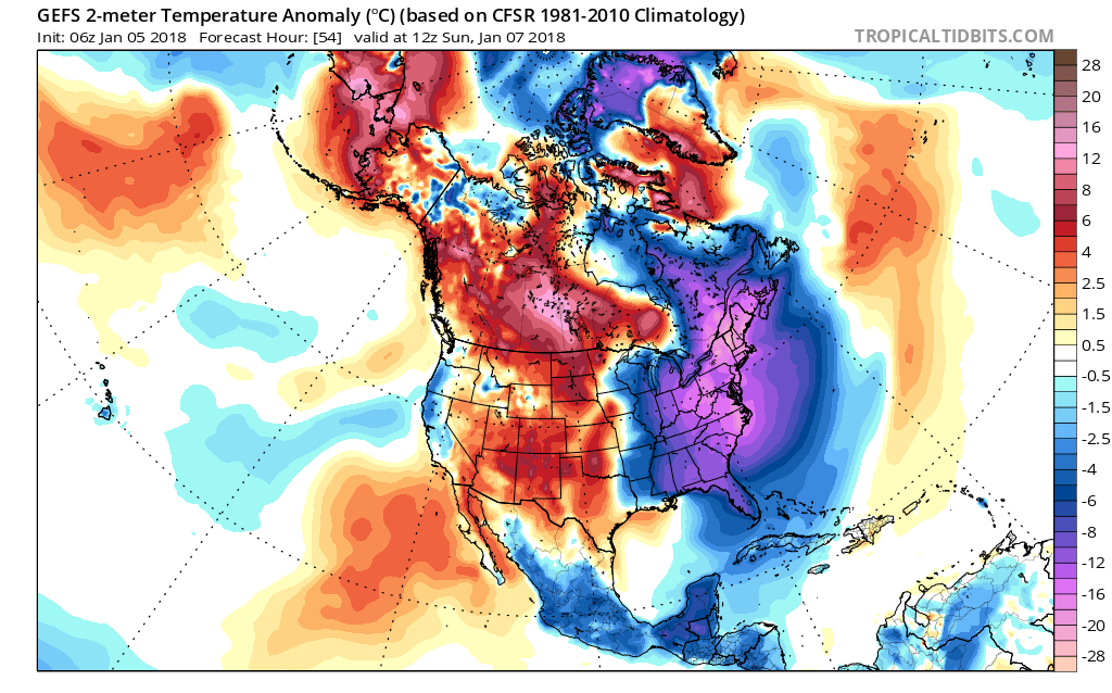
Before then, the cold air will set in place. Bitter cold is expected throughout the weekend. Below are the temperature departures from normal for Saturday and Sunday mornings (1st and 2nd image):
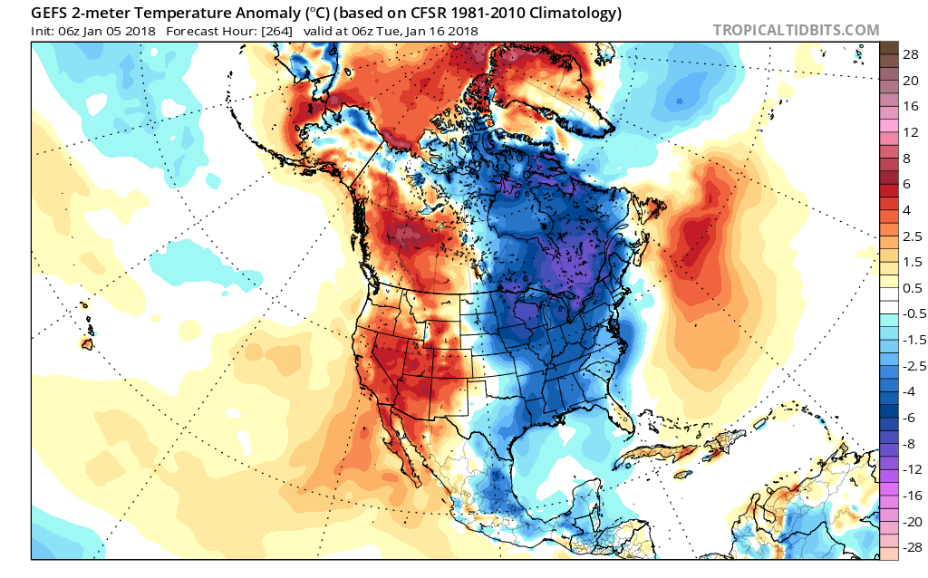
It is also suspected that another cold wave arrives around the 15th. This is in line with our latest long-range forecast, which says January and February will be below average. Check it out on our Youtube channel >>> https://www.youtube.com/user/mjggriff
Jan 15th 7pm:
Stay warm and dress in layers! Also make sure any borderline functioning sources of heat are repaired.
-Mike G
You must be logged in to post a comment.