
Yes it’s hot out there, but we will only be stuck in this pattern for another week or so. A strong cold front will push east from the Midwest around the end of this week. Behind the front, much cooler temperatures will settle in place in many locations of the East minus Florida. This will make for comfortable sleeping weather and reduced energy costs, momentarily.
Here is the GFS temperature departure from normal for the 30th:
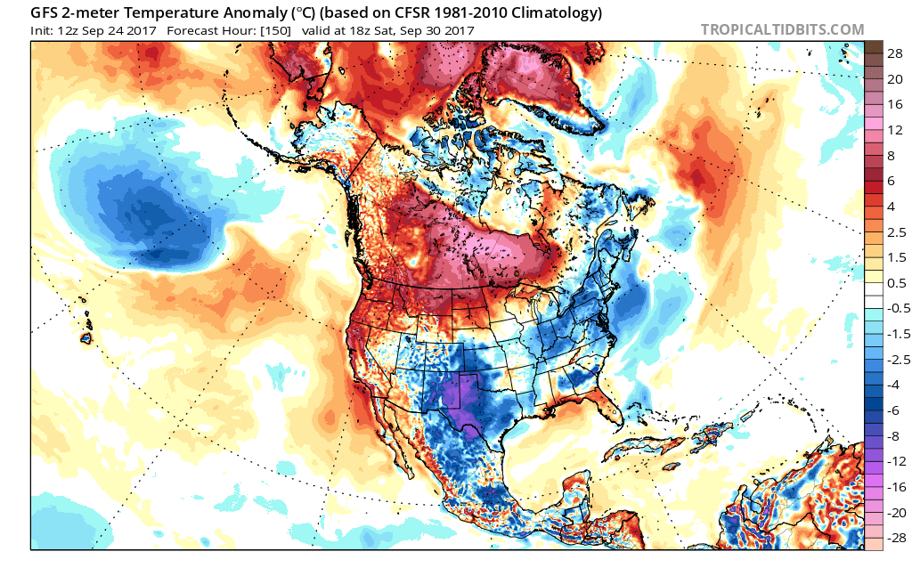
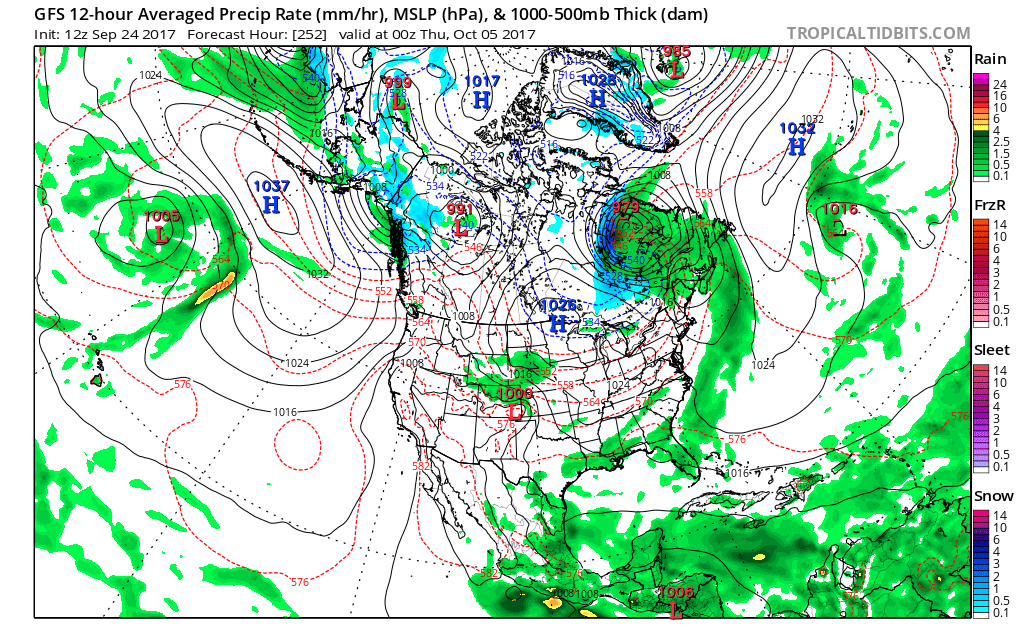
After this brief cool-down, this airmass will moderate once again and we will be warm again. October starts off chilly but then during the first week we will have another warm-up. We could get quite toasty again, but this time it will not last. It will be followed by another cool shot as you can see it building out West in the next model image.

When that next cool shot builds in around the 5th, you can see SNOW up in Canada on the backside of the low! This is a sign that cooler weather is certainly going to be arriving and staying longer than before. This is just a normal sign for fall. As we get into October, we can expect more of the temperature flips, with temporary warm followed by cool shots of air. Enjoy your pumpkin spice everything!
You must be logged in to post a comment.