
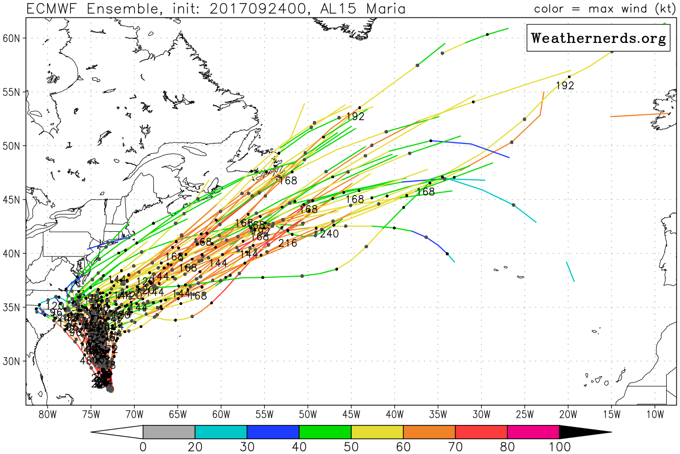
The NHC forecast track for Maria has shifted slightly to the east, as also some of the models have. There is still some concern for the Outer Banks as far as tropical storm-force winds and coastal flooding. Most likely, however, Maria will wait for a bit and then make the right turn out to sea. Therefore the eye will most likely, with high confidence, not make landfall.
Latest Euro spaghetti plot does take some tracks inland, however a majority of the cluster is out to sea and away from land.
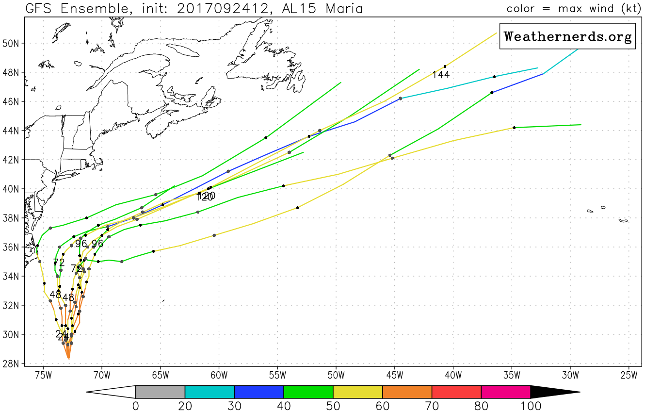
Most of the GEFS ensembles also take Maria out to sea. There is only one outlier that takes the storm inland. Consensus says otherwise with the cluster that has her go out to sea.
Some impacts for the Outer Banks will include stiff tropical-storm force winds, sustained up to 74 mph, however this is only sustained and there could be gusts up to 80mph. This will be due to Maria’s outer rain bands lashing the Outer Banks. So tie down any loose items and prepare to be without power for a few days. Conditions will begin to deteriorate over the next 24-48 hours. Tropical Storm Warnings have not been issued yet at the time of this article, however they will likely be posted in the next 24 hours. Heed all advice, warnings, and advisories from the NHC and your local NWS office. And most of all, stay safe!
You must be logged in to post a comment.