
COMPARISON OF THE GFS, EURO, AND CANADIAN
Well, here we go again. We were discussing the three major models with Irma and what they meant not too long ago. Now, we are dealing with yet another major hurricane, Maria, and we are curious if she will have any impacts to the US. With Irma, the Euro was the winner of the 3 global models.
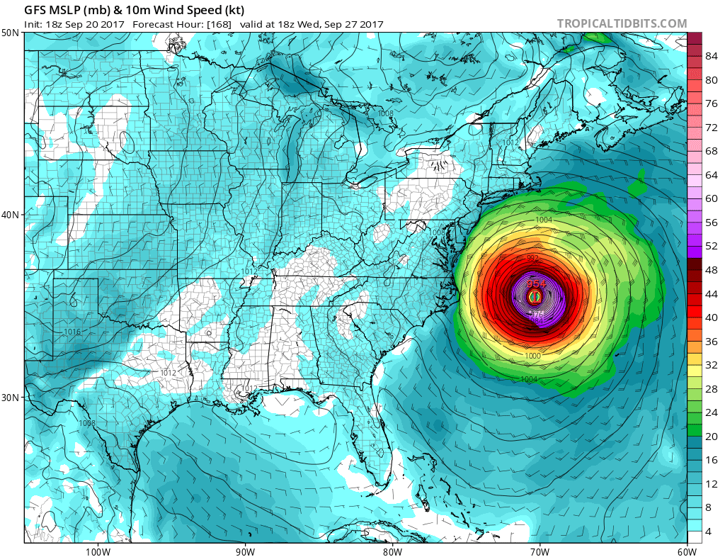
First, let’s take a look at the GFS for around the 27th. It has Maria offshore east of the Outer Banks, NC. It has the storm as 954 mb which isn’t the end of the world but might be a Category 2 or 3 hurricane.
Now we can take a look at the Canadian, or CMC, and what it shows around the 27th, which is the same date as the GFS above. It actually has Maria making landfall or brushing the Delmarva peninsula as a tropical storm, but not a very strong one. This is certainly a possibility given the upper-air patterns which are discussed in another post. Check out the blog here on the site for those details. Here is the CMC:

And finally, let’s go with the “King Euro” and see what it says for the same date and time. It actually has the storm as about a Cat 2 hurricane just off the coast of NC. So there is agreement between the GFS and Euro.

There is still some uncertainty with the path of this storm, and should be monitored for now but nobody should be in panic mode. The next couple frames from the Euro has a close call with NJ and Long Island, then takes it out to sea, so we will watch any developing trends.

You may leave a comment below as long as it’s classy! Please share this post using the buttons below and thanks for reading!
You must be logged in to post a comment.