
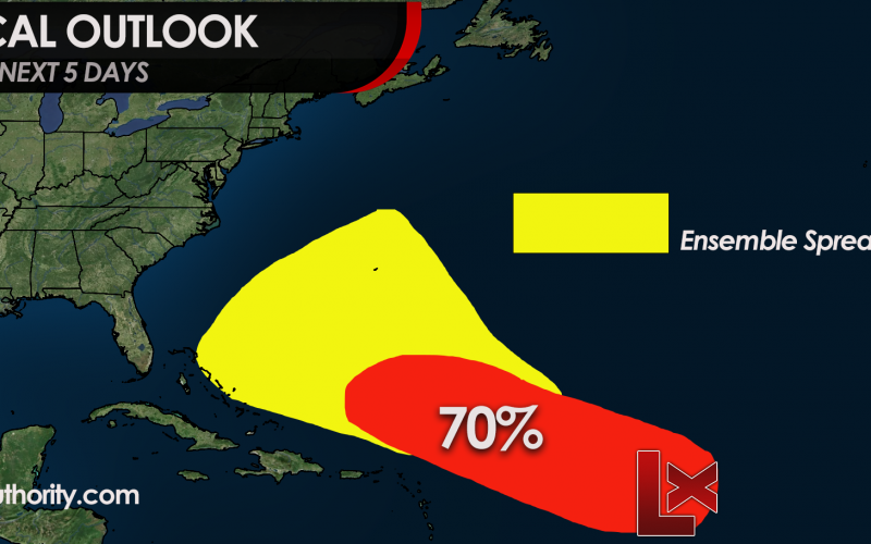
INVEST 92L up to 70% Chance for Formation
After a very quiet hurricane season up until now, the Atlantic has awakened. The NHC is currently watching multiple areas of interest. Our biggest area of concern is in the red (Invest 91L) for our disturbance in the Tropical Atlantic. The NHC gives this spot a 70% chance of developing into something over the next 5 days.
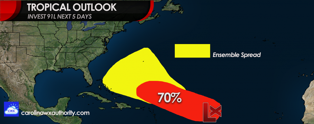
What does that mean for us here in the Carolinas? It just means to watch for now. There is a chance that this system will be a growing concern for us this week, however it could also turn out to sea. We are hoping for the latter.
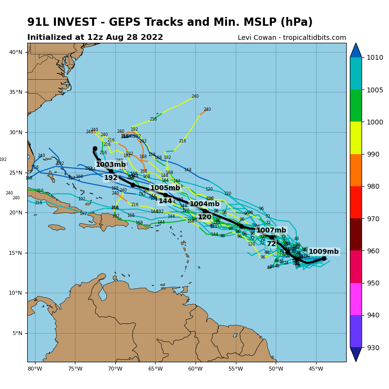
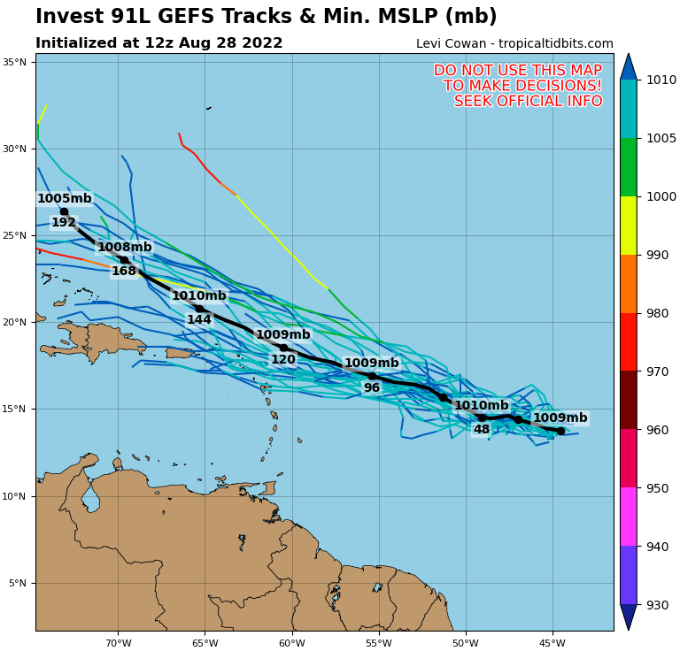
MODEL SPREAD:
Ensembles currently are in disagreement. Below is one example from the Canadian model (we chose this one since it shows land in the image for reference. There is a pretty wide spread.
The latest official info from the NHC regarding Invest 92L:
1. Central Tropical Atlantic:
Recent satellite-derived wind data indicate that a broad area of
low pressure located over the central tropical Atlantic Ocean is
producing winds to near gale force, but the circulation remains
elongated with an ill-defined center.  Although environmental
conditions ahead of the system do not appear conducive for
significant development, a tropical depression, at the very least,
is likely to form later this week while moving slowly toward the
west and then west-northwest at 5 to 10 mph, toward the waters east
and northeast of the Leeward Islands.
* Formation chance through 48 hours...medium...40 percent.
* Formation chance through 5 days...high...70 percent.
Full official discussion: https://www.nhc.noaa.gov/gtwo.php?basin=atlc&fdays=5
Also please check out our “models page” here on our site >>> carolinawxauthority.com/models to follow along!
You must be logged in to post a comment.