
As we end the month of December that had record warm temperatures, we could be looking at a major change in the pattern once the clock strikes 2022. The days of highs in the mid 70s will be gone on Monday and after.
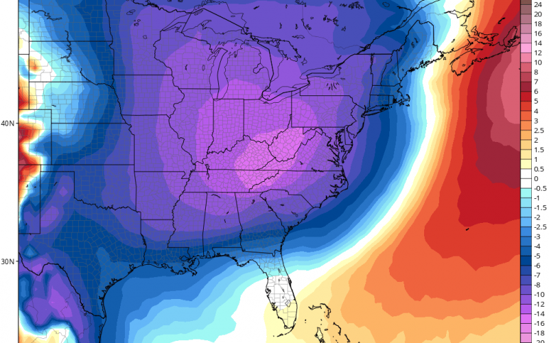
As a rain and snow/sleet mix storm makes its exit on Monday, colder air will wrap in behind. But then by Friday next week, another system could bring us more winter-like temperatures for a while, as shown on the GEFS.
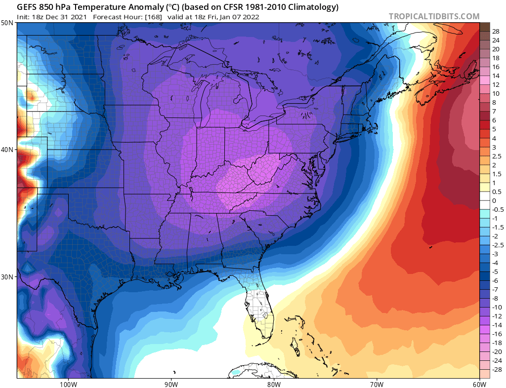
This does not look like a long-term shot of cold, but only for perhaps 2-3 days. There could be some kind of wintry system ahead of this, so watch for another potential wintry mix system later next week, maybe on Thursday.
All for now! Please share!
You must be logged in to post a comment.